Hitting the news over the past few days has been the state government’s release of its preliminary housing targets for each municipality. Glen Eira is being geared to add another 65,000 net new dwellings by 2051 which represents, according to The Age, a 92% increase on current development rates.
Consultation is now open for comment by individuals and organisations. See: https://engage.vic.gov.au/project/shape-our-victoria/page/housing-targets-2051
No one denies the lack of affordable housing, or even housing itself – especially if population growth continues. But to simply decree that what will fix the problem is another 2,000,000 homes by 2051 without any planning for infrastructure, open space, and financial input is in our view sheer madness. Glen Eira has been more than pulling its weight over the past 15 years. To expect a doubling of construction is not planning – it is a recipe for destroying neighbourhoods and liveability – even if this target is possible given the rise in construction costs, labour shortages, and developers’ goal of ever increasing profit.
How on earth these numbers were derived is anyone’s guess. The government website simply justifies the data with the following:
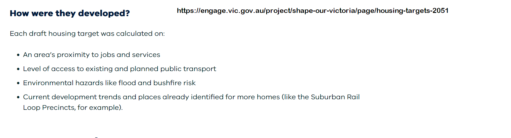
The above ‘criteria’ raise a number of questions:
- Glen Eira has 9 railway stations in 38.7Km of land. Add to this 6 Major Activity Centres/Comprehensive Development Zones, and about 11 neighbourhood centres that total a good proportion of available land then we can expect most of Glen Eira to be ‘built out’. When Glen Eira is compared to its neighbours and their targets we are certainly being overdeveloped. For example here are the targets for councils lumped together in the government map (highlighted as green) together with their size in square km –
Hobson’s Bay – 31,000 – 64km
Maribyrnong – 46,000 – 31.2 km
Moonee Valley – 57,000 – 43 km
Merri-bek – 72,000 – 51 km
Darebin – 72,000 – 54km
Banyule – 47,000 – 63km
Booroondara – 67,000 – 60 km
Manningham – 39,000 – 113 km
Whitehorse – 79,000 – 64 kn
Monash – 72,000 – 82km
Bayside – 31,000 – 37 km
Kingston – 59,000 – 91 km
As this shows, apart from Maribyrnong, Glen Eira is far smaller than all other council areas. Add to this the lack of open space, tree canopy loss, and wide areas subject to flood, then we are indeed in deep shit if this proposal is ever to eventuate.
Not a single word refers to population DENSITY and what the repercussions of living with increased density will mean in terms of traffic congestion, lack of open space, urban heat, overshadowing, etc. The basic question of what is an ‘acceptable’ number of people living in each square km is never addressed – and this assumes that infrastructure has been built, that jobs are available, schools nearby, roads accessible, and public transport vastly improved.
The question should be whether Glen Eira has already achieved saturation point. Below we present profile.id data that shows population density as of 2023 in our suburbs. What will this be in 2051 when we add another 65,000 dwellings?
DENSITY PER SUBURB
BENTLEIGH – The 2023 Estimated Resident Population for Bentleigh is 19,360, with a population density of 4,025 persons per square km.
BENTLEIGH EAST – The 2023 Estimated Resident Population for Bentleigh East is 31,214, with a population density of 3,476 persons per square km.
CARNEGIE – The 2023 Estimated Resident Population for Carnegie is 19,412, with a population density of 5,266 persons per square km.
CAULFIELD – The 2023 Estimated Resident Population for Caulfield is 5,905, with a population density of 4,009 persons per square km.
CAULFIELD NORTH – CAULFIELD EAST – The 2023 Estimated Resident Population for Caulfield North – Caulfield East is 19,452, with a population density of 3,566 persons per square km.
CAULFIELD SOUTH – The 2023 Estimated Resident Population for Caulfield South is 12,748, with a population density of 3,897 persons per square km.
ELSTERNWICK-GARDENVALE – The 2023 Estimated Resident Population for Elsternwick – Gardenvale is 12,455, with a population density of 4,354 persons per square km.
GLEN HUNTLY – The 2023 Estimated Resident Population for Glen Huntly is 5,202, with a population density of 5,824 persons per square km.
MCKINNON – The 2023 Estimated Resident Population for McKinnon is 7,205, with a population density of 4,536 persons per square km.
MURRUMBEENA – The 2023 Estimated Resident Population for Murrumbeena is 10,449, with a population density of 3,976 persons per square km.
ORMOND – The 2023 Estimated Resident Population for Ormond is 8,956, with a population density of 4,323 persons per square km.
ST KILDA East – The 2023 Estimated Resident Population for St Kilda East is 4,480, with a population density of 4,686 persons per square km.
TOTAL GLEN EIRA – The 2023 Estimated Resident Population for the City of Glen Eira is 156,837, with a population density of 4,056 persons per square km.
Source: https://profile.id.com.au/glen-eira/about?WebID=10
Now is the time to provide your input into this government ‘plan’ if you don’t want to see your neighbourhoods completely destroyed. See the above link and please respond. And wouldn’t it be good if for once our council came out with some formal opposition to such planning?

June 17, 2024 at 1:14 PM
Reading the gov survey reminds of council’s surveys. Complete rubbish. 2m by 2051 is impossible anyway. They can rezone all they like but it won’t happen. what will happen is that millions pour into developers hands, the big ones, and nothing will be ‘affordable’. Politics at its best. Time to get rid of this incompetent government and its puppets like Glen Eira Council and useless councillors.
June 17, 2024 at 1:21 PM
Exactly! Forget the numbers, how affordable will it be to buy or rent in GE? How affordable is it now?
June 18, 2024 at 7:36 AM
vote out Labor.
June 18, 2024 at 2:06 PM
The plan is continuing an inglorious tradition of inept government. Sure, we can rip to shreds their rhetoric but that won’t in itself change their behaviour, or remove the major parties’ dependence on developer donations–donations made, as Operation Sandon documented, to influence planning decisions.
I doubt very much the Glen Eira numbers were based on calculations, or we’d be able to see the calculations. It’s looking much more like a wet finger in the air.
On so many fronts we’ve had 25 years of planning failures. The government plans for indefinite growth aren’t sustainable, the government doesn’t invest in infrastructure to support the growth, it doesn’t provide for equitable amenity, it completely disregards access to open space or solar access, it is clueless about the services available locally and the distances people are actually travelling through necessity.
We have modern builds riddled with flaws, clad with dangerously flammable material (but the public isn’t permitted to know where). There’s been industry capture, and VCAT’s Planning and Environment division acting on behalf of developers. There’s a Shared User Path declared a major project to bypass normal planning processes. And there’s my local member, promoted beyond ability, who asserted to me that there were no circumstances under which the government should ever compensate residents when the government fails to comply with its own amenity standards.
June 18, 2024 at 5:58 PM
You’ve described the situation perfectly. Political pie in the sky. They can’t even build the rail loop without a huge blowout and delay. Suddenly social housing is big on the agenda so they flog 90% off to developers to get it started. Next on the list is open space and sustainability. That’s why nothing except hot air goes into planning schemes.
Everything is smoke and mirrors. All councils should tell these morons to ***** off. They won’t because they also are addicted to the rate rises and employing more hopeless people who don’t give a stuff.
June 18, 2024 at 2:34 PM
Labor’s gone screaming bloody mad, totally insane. Its time to implement mandatory drug testing at Spring Steet.