Council’s first disseminated publication on their structure planning process included the map provided here –
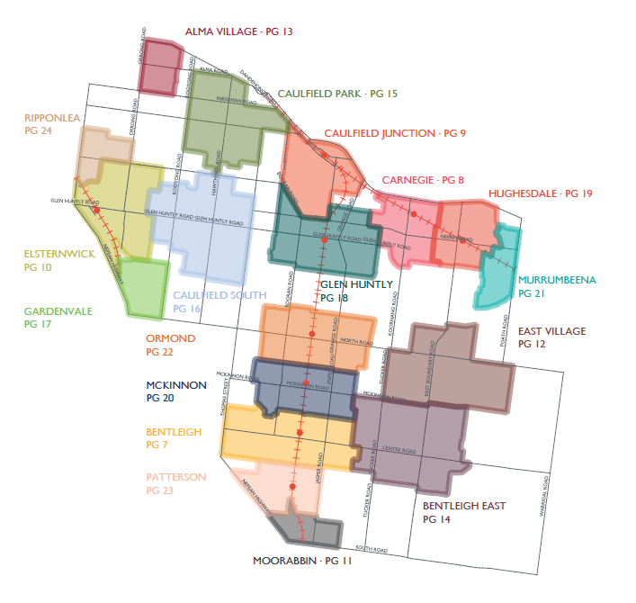 It was conveniently described as nothing more than the proposed ‘study area’. Recent publications have shown that nothing could be further from the truth. These ‘study area’ borders are now the ‘new’ borders for the activity centres as confirmed with the Bentleigh, Carnegie and Elsternwick latest version of the ‘concept plans’. What residents were never told and is now clear is that the intention was always to promote further development and to turn areas zoned as Neighbourhood Residential (ie 2 storeys) into sites now available for 3 and 4 storey development. Thus far our tally indicates that hundreds of properties will be so affected in just 3 of these ‘activity centres’. Some even worse – ie 4 storeys to a potential 12 storeys in Carnegie.
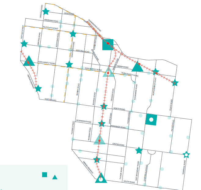
Yet, apart from the first map shown above, every other illustration purporting to reveal the overall framework has been along the lines of the following bland, innocuous, and far from revealing portrayal –
Questions on changes to zones were fobbed off. Assurances to residents that there would be no expansion(s) proved untrue. The list goes on and on. Worse still of course is how residents have been fed ‘information’ in dribs and drabs making it extremely difficult to grasp an overview of what is really going on. And this continues even now – ie the latest Planisphere document purports to be an ‘urban design’ yet not a single word is featured on proposed setbacks, and existing schedules to the zones. That critical information is still being held back when it undoubtedly would have featured prominently in any planning thinking.
Further, when other councils can provide maps that are clear and precise, that feature street demarcations that are legible, Glen Eira deliberately avoids such clarity. Better to keep everyone in the dark we suspect until it is too late.

July 29, 2017 at 11:25 AM
So which councillors stood on a platform of expanding the activity centres, increasing overshadowing, adding to existing congestion, removing residential amenity protections and changing utterly the character of established residential areas? Take it to an election if they think it is good policy. Find out what the community really thinks.
July 29, 2017 at 6:00 PM
Very sad how quickly the new councillors have fallen into line. Election promises have disappeared into the ether and none show any initiative to change the prevailing anti resident culture.
July 29, 2017 at 12:03 PM
I specifically asked Aidan about the expanded “project scope” at one of the community consultations meetings where no councillor attended, and yes, he gave me a devious, deceitful response. I had a strong suspicion just why at the time, and sure enough, my suspicions were justified.
July 29, 2017 at 12:37 PM
God knows what’s in store for the neighbourhood centres. Everything will become 6 storeys along the main strips at least. 80% of Glen Eira will now be waving come on in to developers.
July 29, 2017 at 4:19 PM
Actually they want it all, and in a little time they have it all, rubber-stamped by the councillors.