A long but important post – so our apologies!
In the past week, The Age has published several articles on high rise towers in the Melbourne CBD. The articles are based on research done by Leanne Hodyl, the 2014 Churchill Fellow. We’ve uploaded her full report HERE.
Whilst the report focuses primarily on ‘high rise’ towers and the city centre, some of the content applies directly to planning everywhere and especially to what is happening in Glen Eira. Hodyl recommends:
- Density controls
- Apartment standards
- Separation between towers/buildings, and she says –
- Planning policies should aim to ensure that this growth is managed well; to ensure that the cumulative effect of alldecisions made in the city make the city a better place to be and balance private and public benefit. (page 11)
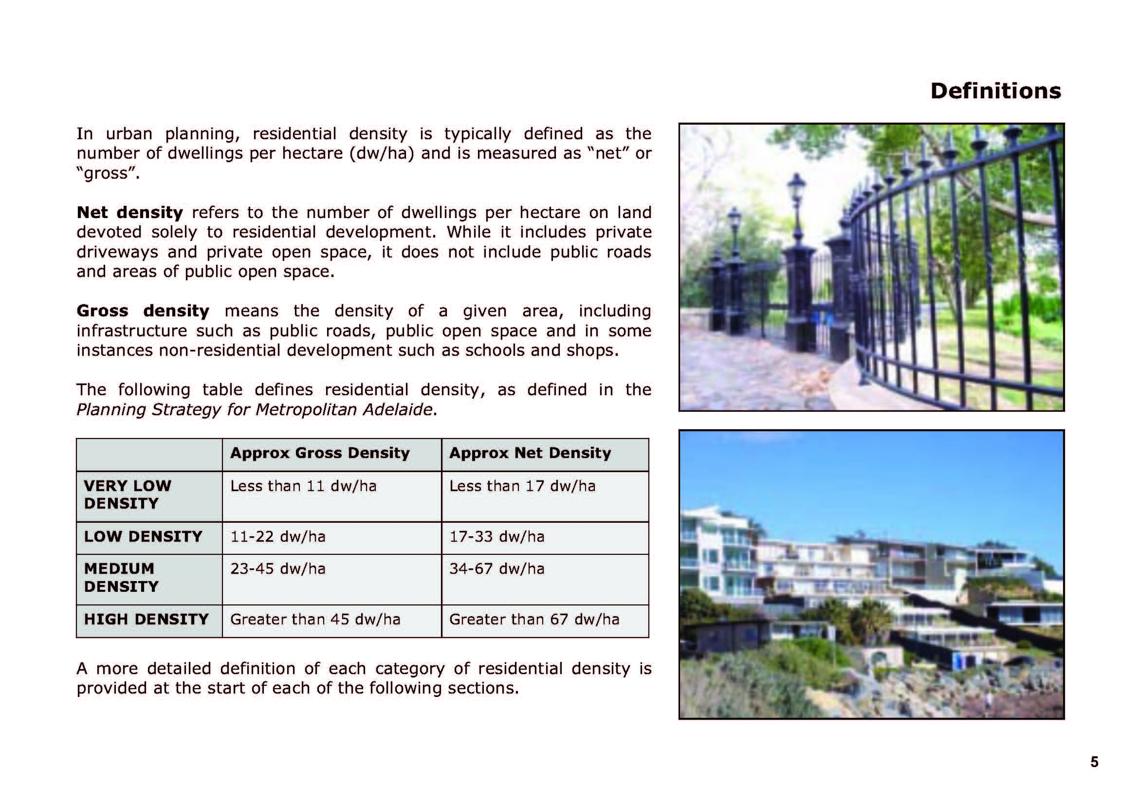
However, without clear definitions and standards of what constitutes ‘low’, ‘medium’ and ‘high density’ (in fact what ‘density’ even means and how these variable measures should be applied, and in which areas), we are in a state of anything goes.
Glen Eira’s new zones provide enough evidence to show that there has been no consideration whatsoever as to the cumulative impacts of rapid development. Nor has there been any attempt to gauge what is an appropriate ‘balance between private and public benefit’. Instead, lines have simply been drawn on a map consigning vast areas of residential land as booty for developers and speculators.
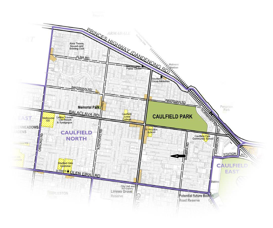
Below is a list of all the applications that have been submitted in the past 18 months or so, for one single stretch of road – Neerim Road. Some applications are still awaiting approval. Others have been granted permits either by council or VCAT.
We urge readers to carefully note the following:
- Many of these developments are literally side by side. We assume that over time the ‘gaps’ will be filled in with further 3 and 4 storey applications.
- Assuming that all of those still awaiting their permits will have them granted, this equals just on 2 hectares of Neerim Road that is going to be developed with 4 and 3 storey boxes and, in Mixed Use/Commercial zones, even higher. We anticipate that at least 40% of these new dwellings will be single bedroom apartments given current trends and the financial rewards.
- The total of new dwellings designated in just under 2 hectares of land will be around 400+ (366 known, and others unknown since council’s register is incredibly short on detail in many instances)
- According to Hodyl’s paper, this means that certain sections of Neerim Road, in terms of dwelling DENSITY, will outstrip what is happening in the CBD and even some of the other major international cities.
- What impact this will have on the public realm has NOT been considered by council. Much less has traffic congestion, lack of public open space, and general amenity – not to mention heritage, neighbourhood character, water tables etc.etc.
- So when is ‘saturation’ or ‘capacity’ (council’s latest buzz word) finally arrived at? When a few hundred yards of Neerim Road contains 600 dwellings? And how much will residents have to fork out to support drainage infrastructure, traffic management instead of developers providing their fair share via a development contributions levy, or a community levy?
As Hoydl implies, a one size fits all approach to huge swathes of land is nothing more than a recipe for environmental and social disaster on a grand scale.
We urge readers to consider the ‘facts’ about Neerim Road. They are indeed frightening – not only for this thoroughfare, but for all the neighbouring residential streets.
143-147 Neerim Road, Glen Huntly – Construction of a three storey building comprising 32 dwellings above a basement car park and alteration of access to a Road Zone Category 1 (GRZ1) (`1700sqm)
149-153 Neerim Road & 4 Hinton Road GLEN HUNTLY VIC 3163 – Construction of up to seventeen (17) double storey dwellings and alteration of access to a Road Zone Category 1 – Amended permit (GRZ1) (`1700sqm)
179 – 181 Neerim Road, CARNEGIE VIC 3163 – Construction of a three storey building comprising up to 19 dwellings and basement car parking. Amended permit (GRZ1)(`1200sqm)
247-251 Neerim Road CARNEGIE VIC 3163 – Construction of a four (4) storey building comprising 48 dwellings above 2 levels of basement car parking, reduction of statutory requirements for visitor parking and alteration of access to a Road Zone Category 1 (RGZ1) (`2100sqm)
253-255 Neerim Road CARNEGIE VIC 3163 – Construction of four (4) storey building comprising multiple dwellings (RGZ1) (`1150sqm)
257 Neerim Road CARNEGIE VIC 3163 – Construction of a three (3) storey building containing seven (7) dwellings and altered access to a Road Zone Category 1(RGZ1) (`630sqm)
259-261 Neerim Road CARNEGIE VIC 3163 – Construction of a four-storey building comprising twenty-eight (28) dwellings, associated car parking and alteration of access to a road in a Road Zone, Category 1 on land affected by the Special Building Overlay and Parking Overlay (permit) (RGZ1) (`1170sqm)
276-280 Neerim Road CARNEGIE VIC 3163 – Development and use of the land for the purpose of a five storey building with retail premises at ground floor, up to forty two dwellings and basement car parking, a reduction in the standard car parking requirements and waiver of a loading area (amended permit)(MUZ) (`1050sqm)
15-17 Belsize Avenue CARNEGIE VIC 3163 & 316-320 Neerim Road CARNEGIE VIC 3163 – Construction of a four storey building comprising up to forty seven (47) dwellings above two levels of basement car parking (permit)(RGZ1) (`1950sqm)
322-326 Neerim Road CARNEGIE VIC 3163 – Construction of a four (4) storey building comprising 38 dwellings and associated basement carparking (RGZ1)(`1350sqm)
328-330 Neerim Road CARNEGIE VIC 3163 – Construction of a four storey residential building comprising up to 16 dwellings with associated car parking, the waiver of three visitor parking spaces and alteration of an access way to a road in a Road Zone Category 1 (permit) (RGZ1) (`800sqm)
332-334 Neerim Road CARNEGIE VIC 3163 – Construction of a four (4) storey building comprising twenty six (26) dwellings above a basement car park; Reduction of the requirement for visitor parking; and Alteration of access to a Road Zone Category 1 (permit) (RGZ1) (`1130sqm)
339-341 Neerim Road & 19-21 Belsize Avenue CARNEGIE VIC 3163 – Construction of a four-storey building comprising up to thirty (30) dwellings and a basement car park and reduction of the visitor car parking requirement (permit granted for 3 storeys and 27 units)(RGZ1) (`900sqm)
365-367 Neerim Road CARNEGIE VIC 3163 – The construction of a three (3) storey building above basement comprising of sixteen (16) dwellings and creation of access to a road in a Road Zone Category 1(GRZ2) (`750sqm)
401-407 Neerim Road CARNEGIE VIC 3163 – Construction of a five storey building comprising of shops and dwellings above basement car park, a reduction in standard car parking requirements and to create access to a Road Zone Category 1 (permit)(MUZ) (`2030sqm)
Finally, we’ve linked to a South Australian Government Report , which at least attempts to define low, medium and high density. Compare what’s happening in Glen Eira with these figures and how our council still insists that RGZ zones are ‘medium density’!!!!! 

 Next, is the issue of size. The entire street is roughly 85 metres long. The plans DO NOT intend that the entire street be blocked off, just half – since there are driveways that can’t be blocked. This means that hundreds of thousands of dollars will be spent on creating a ‘park’ that will still be part street and not fulfill the ‘multiple purposes’ that was the recommendation of the OSS.
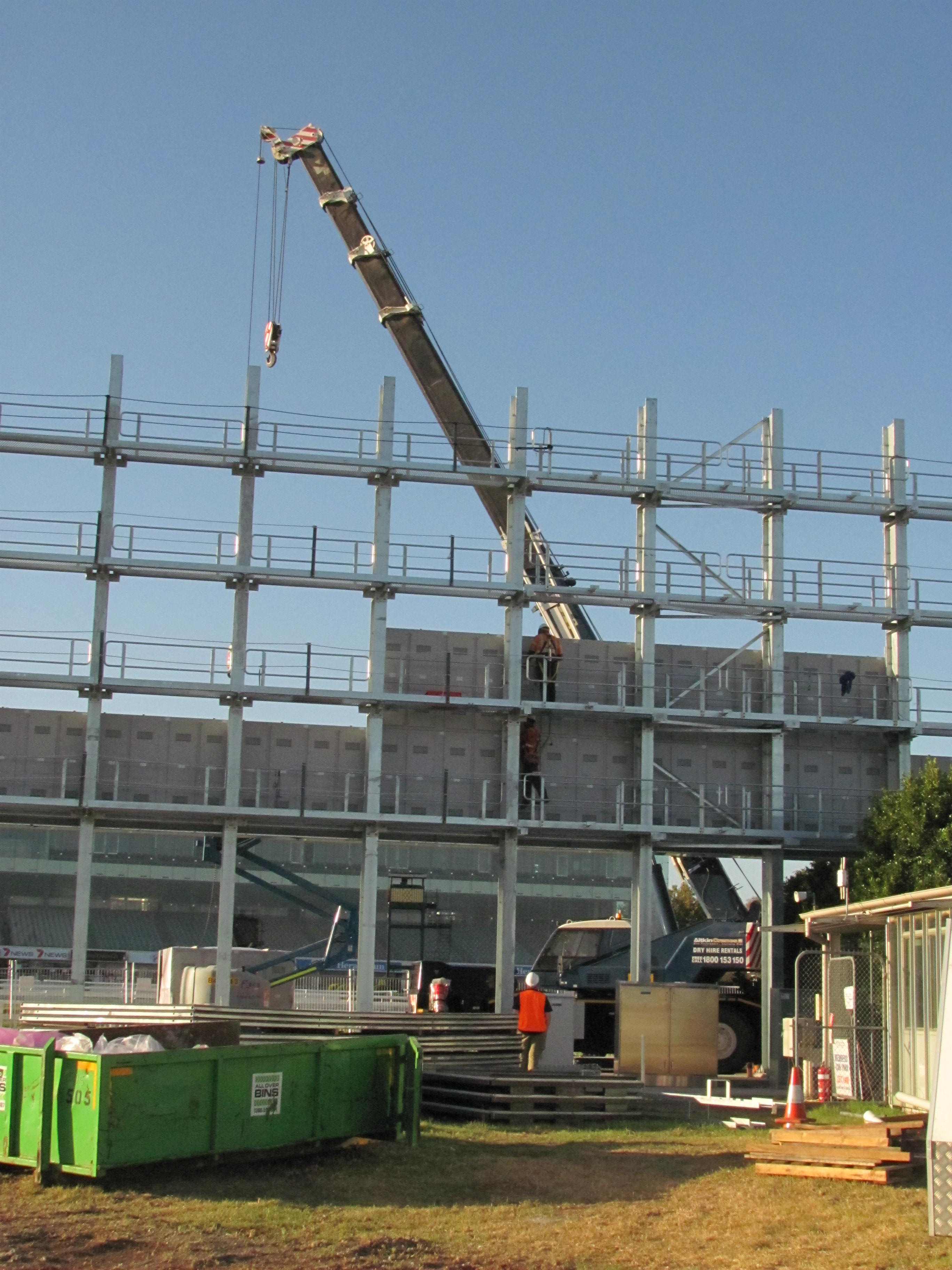
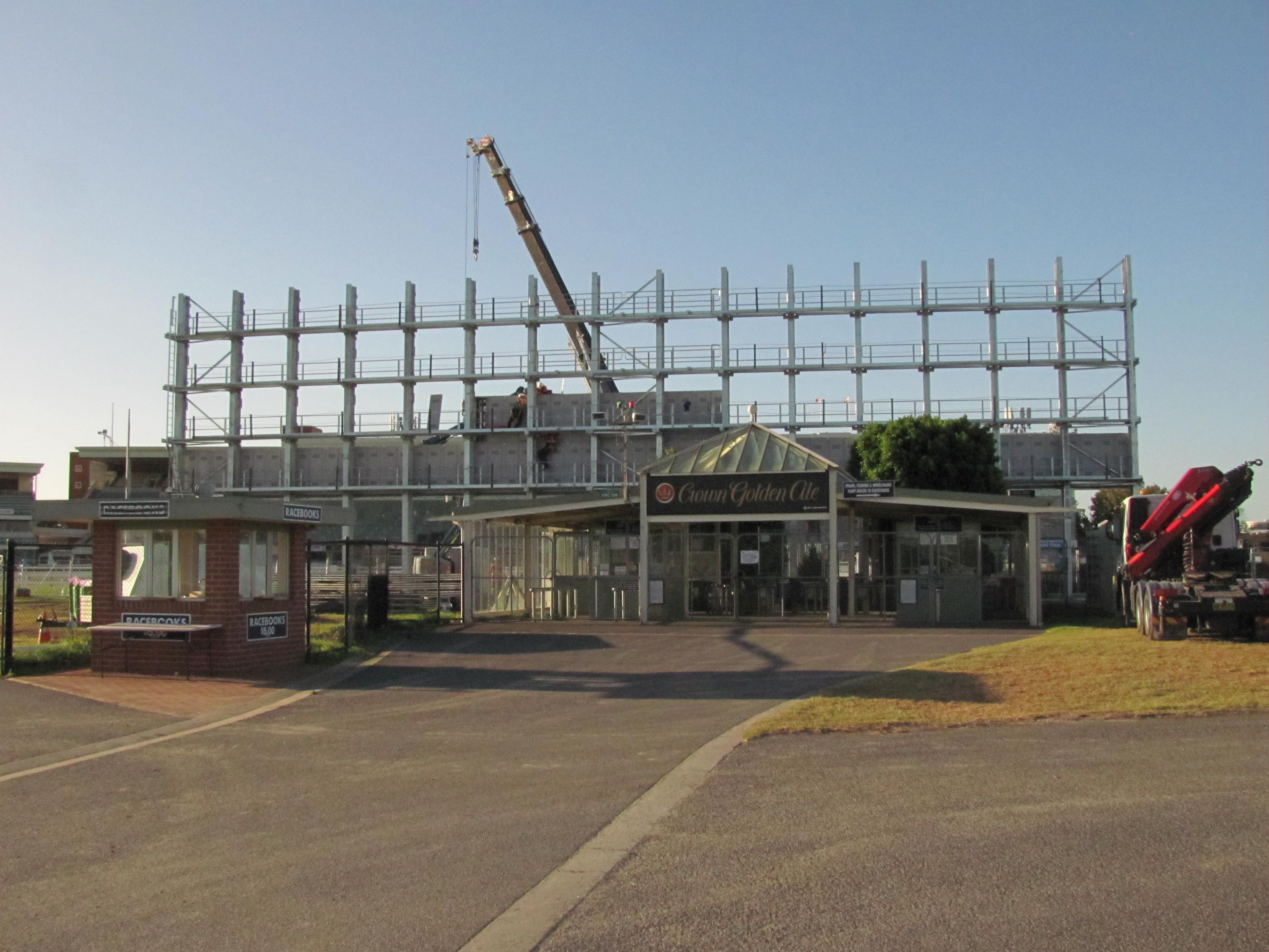
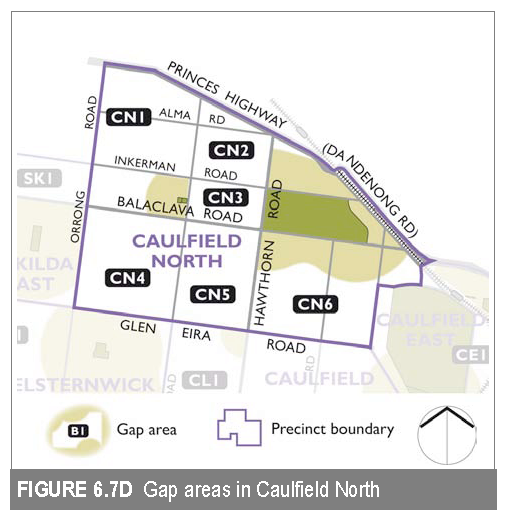 The proposed street closure is in gap area CN6. The ‘conclusion’ and hence the ‘recommendation’ that is contained within the OSS (page 170) for this area states: Improve access to the future Crown Allotment 2031 or other future open space associated with Caulfield Racecourse.