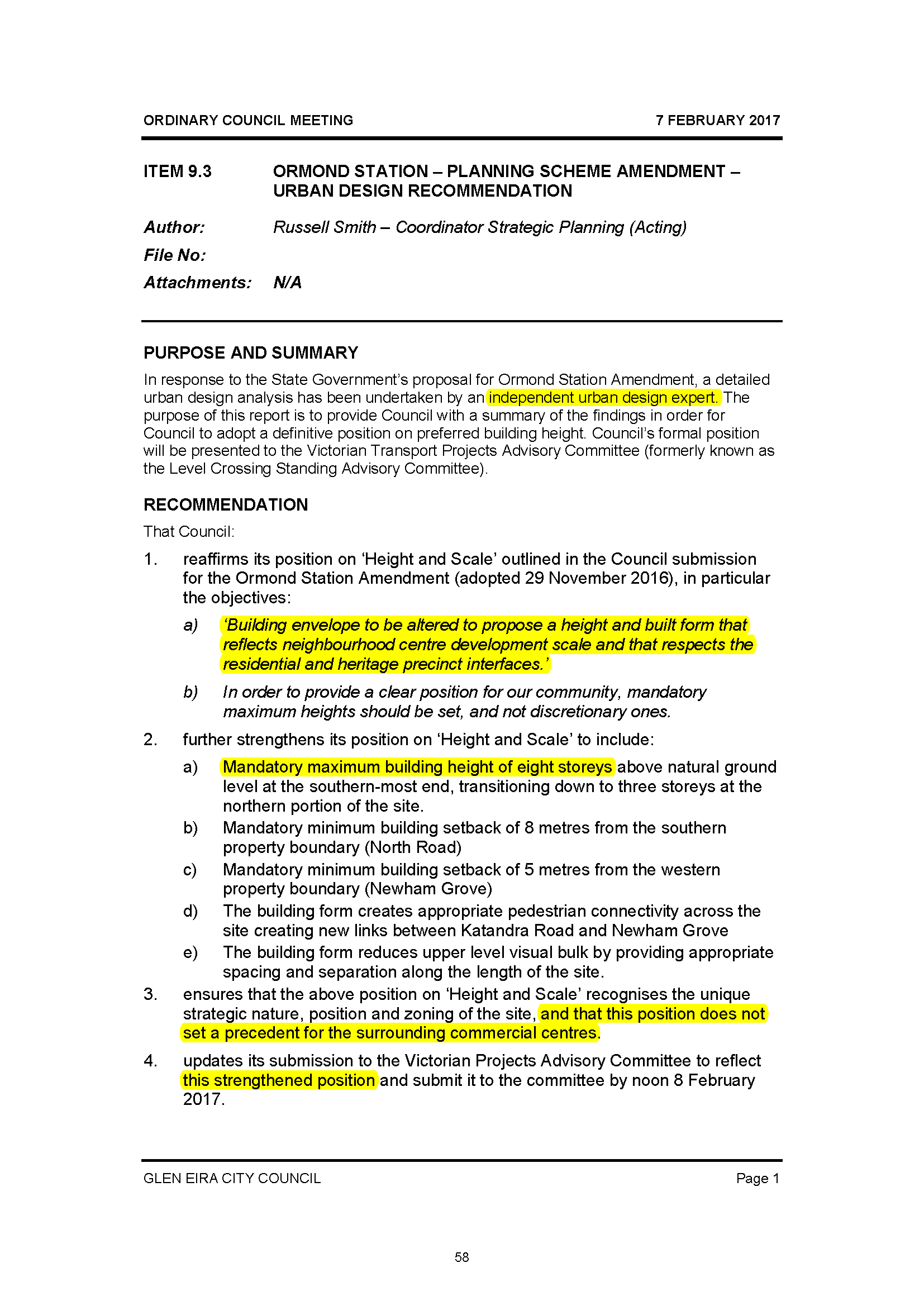
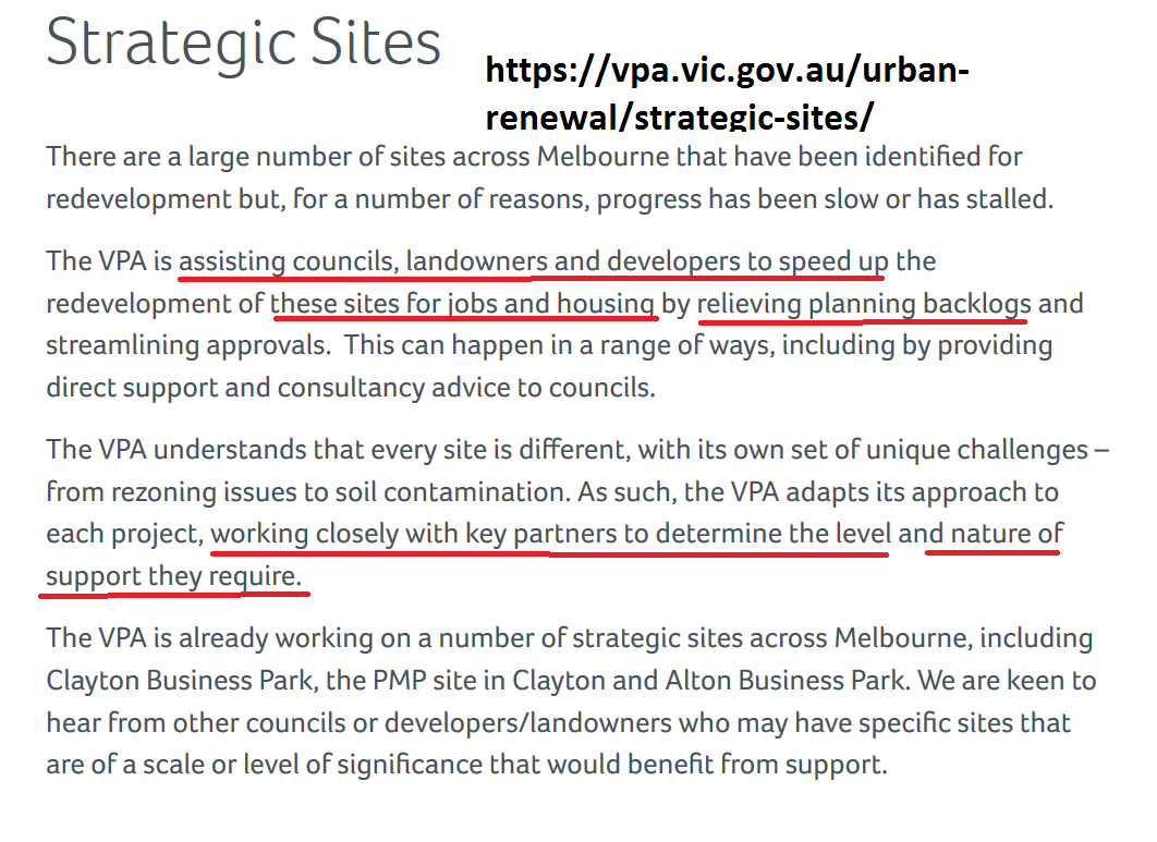
The plans for the development of Virginia Estate have taken a new turn with the proposed ‘partnership’ between council and the Victorian Planning Authority (VPA). This government body is primarily charged with the responsibility of overseeing ‘urban renewal’, especially in growth areas. They are also involved with large development sites within the metropolitan area such as the Monash/Clayton precinct and now East Village. Here is what their brief states –
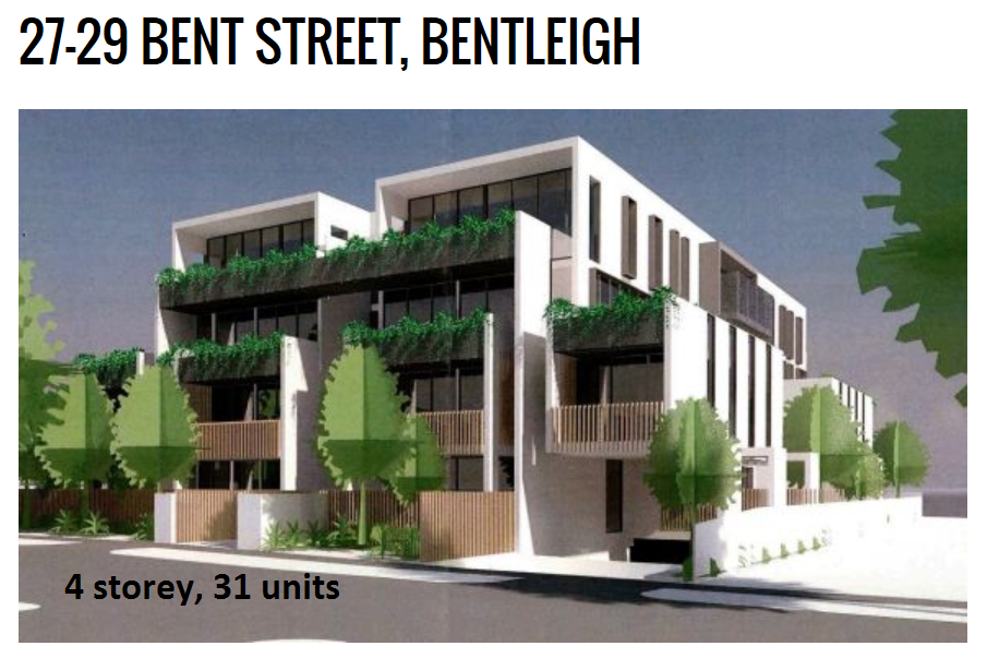
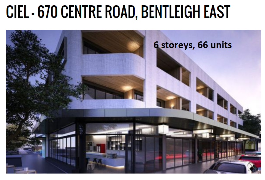
All of the above would indicate that government, developer and council are keen to push through rezoning and amendments that will set the ball rolling for Virginia Estate. There is no doubt that at the latest stated figure of 24 hectares, Virginia Estate will be developed, and a very large component will feature residential accommodation. What concerns us is the role that the community will play in this development. The letter from the VPA, included in the agenda, outlines a brief timetable schedule. Please note carefully the following:
- The time frame for the ‘delivery’ of a draft structure plan for the site is basically 3 months. Yet, the officer report keeps insisting that this will be part of council’s review of its ‘activity centre strategy’ – not due to be completed until 2018 at the earliest. Thus, what porkies are we being fed?
- Why aren’t the community involved right from the start instead of having the draft structure plan thrust down their throat and then asked to comment? We all know what this means and how little is changed once the ‘draft’ of anything is completed.
- Why does the officer report emphasise ‘business’ and ‘residential’ barely rates a mention?
We’ve uploaded the proposed schedule. Clearly discussions between government, developer and council have been ongoing for some time given this timeframe. We’ve also uploaded the full agenda item (HERE) so readers can see for themselves the lack of real detail provided.

In conclusion, VPA does have a role here and council is undoubtedly better off financially if much of the cost comes out of government and developer coffers. What we are concerned about is the level of genuine consultation with the community and whether development gets the go ahead well and truly before infrastructure, transport, etc. is completed.