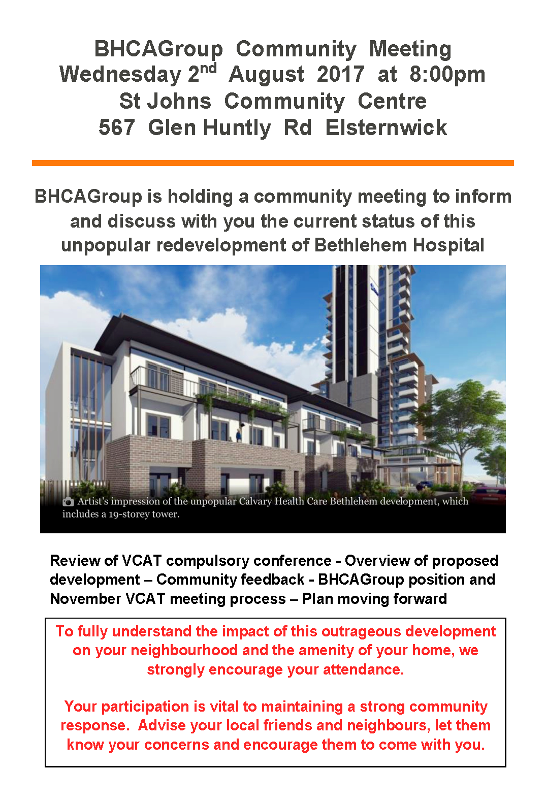
Item 9.3 – Draft Structure Plans
Here is the ‘discussion’ that occurred in regard to the Bentleigh, Elsternwick and Carnegie concept structure plans. We ask residents to read the following carefully and to consider these points –
- What is the justification for the proposed ‘trade offs’? Where is the evidence to support this?
- The absurb reduction of everything to the most simplistic and illogical level that is not a fair representation of the facts – ie development versus no development (when the issue is appropriate development); ‘vibrancy’ versus ‘safety’ etc. etc.
- No reference to the impact of Wynne’s VC110 and its likely influence on dwelling stock
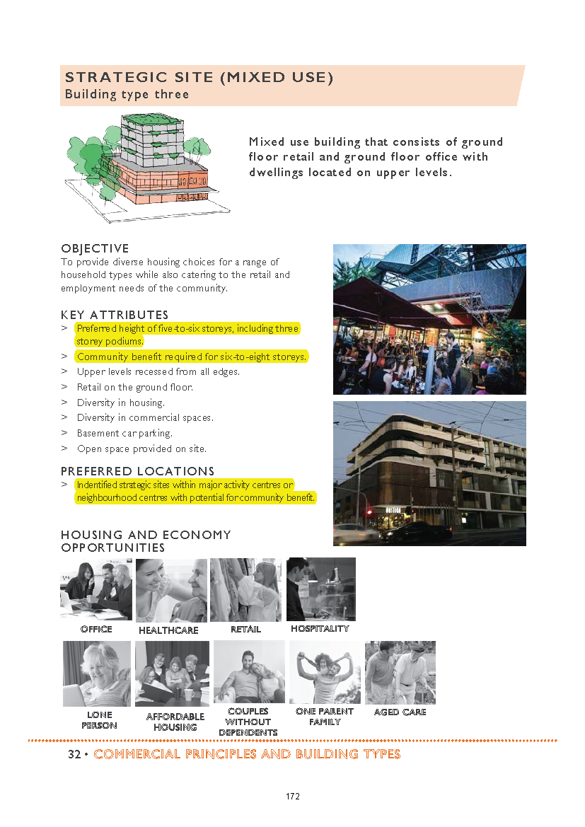
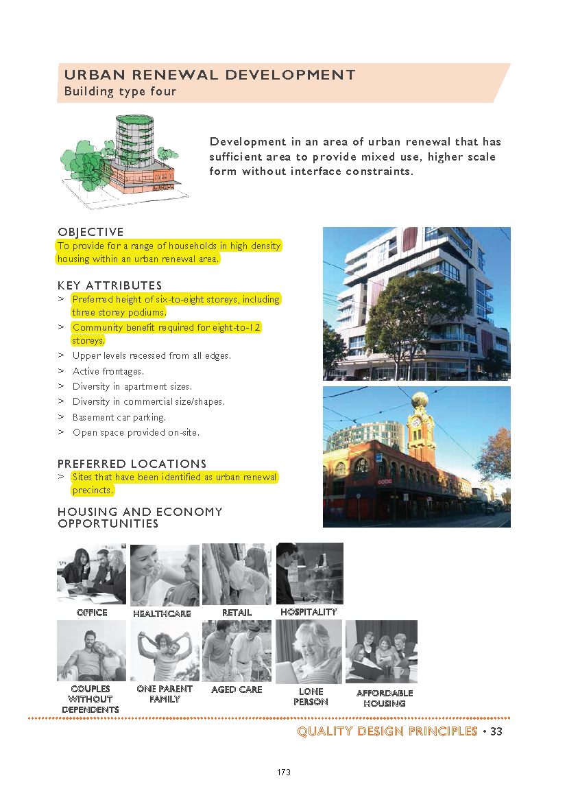
- No explanation as to why and how 12 and 8 storeys were plucked from the air and barely rates a mention – only 2 out of 9 councillors even bothered to refer to this ‘proposal’
- No explanation as to why so much stands in opposition to resident suggestions and responses, and
- The countless contradictions inherent in most councillors’ comments
- The explicit acknowledgement that the introduction of the zones has been a disaster – and remember who were the current councillors who allowed this to go through in secret – Hyams, Magee, Delahunty, Esakoff!
++++++++++++++++++++++++++++++++++++++++++++++++
Motion to accept moved by Davey and seconded by Silver
DAVEY: called it a ‘fabulously detailed piece of work’ and ‘accessible by anyone who reads it’. It ‘also makes a lot of sense’ and is ‘very detailed’ on housing design/ Apologised for losing her voice and handed ‘it over’ to others.
SILVER: said there are 2 documents – the ‘quality design principles’ and then the structure plans themselves. The latter ‘allows us to control’ the heights in commercial zones and they also ‘have to outline the sorts of residential development’ they want. They’ve set up a ‘typology’ and designated the designs they want into the surrounding streets. The draft structure plan is a ‘bit more interesting because they are looking at the exact proposals’. These aren’t ‘set in stone’ because they are going out for community consultation. The car park proposals for Staniland Grove ‘I have some concerns about’ also green space for where the library currently is. Had some concerns particularly ‘about the impact on traders’ with the Staniland car park. Thought that ‘some of these ideas will enhance the amenity of the area’ but they are ‘of course open to alternate ideas’.
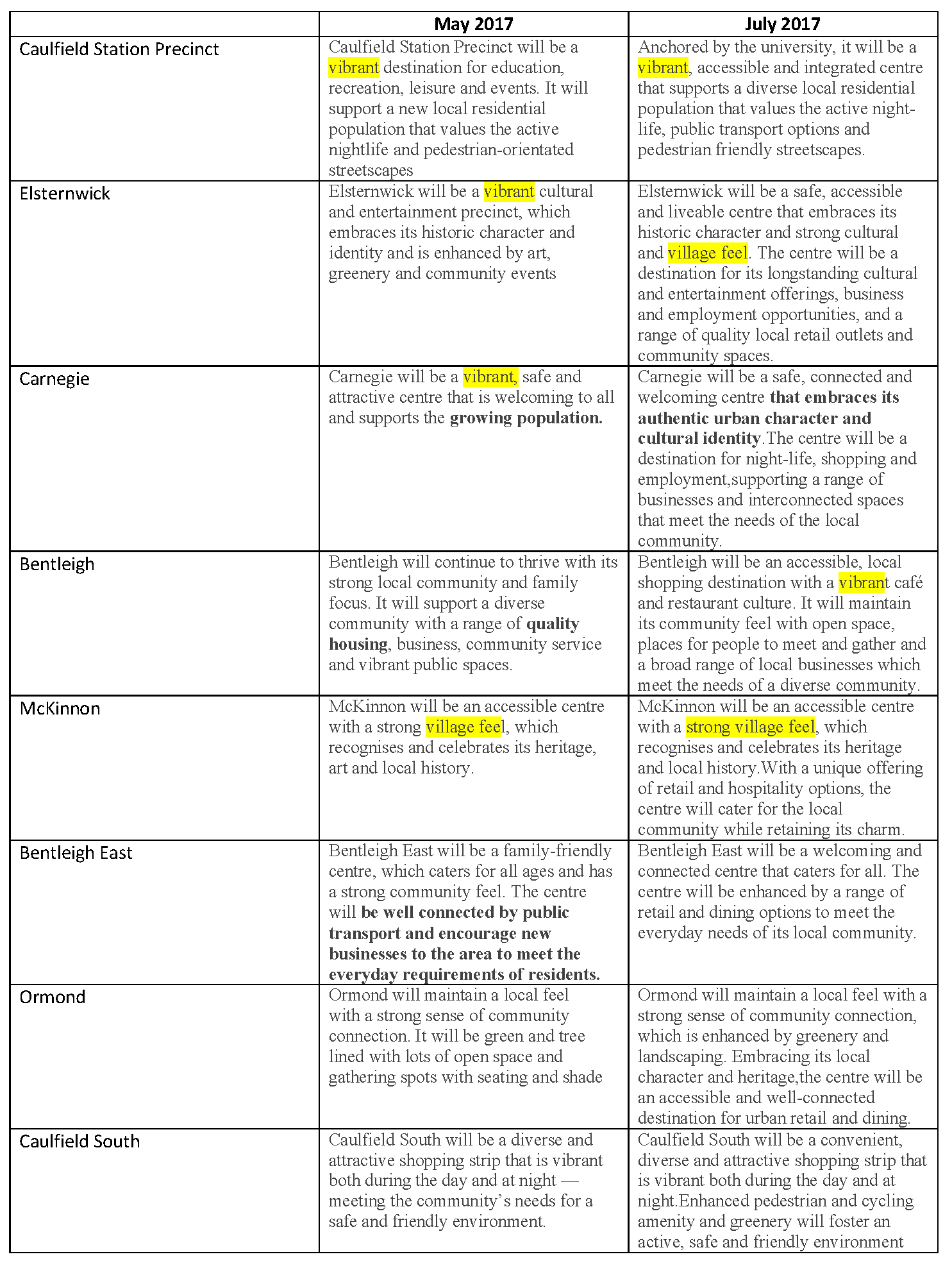
ESAKOFF: said councillors consider all of Glen Eira and not just their own wards. And ‘this item will impact’ all of the municipality. Hoped people do ‘look at these guidelines in great detail’ and respond. She ‘agreed and endorse(s) the majority’ of recommendations. Everyone wants to see good buildings and nice gardens, but there are some things that ‘I have some reservations about’. An example is ‘avoiding the secluded garden’ in front yards. Asked ‘what if the front of a property is the part that faces north?’ Said that ‘surely the environmental design would take precedence over a line item like that?’ So if someone does have a property that ‘faces north that they won’t be allowed to have’ a front secluded garden. We want ‘that northern sun’ especially in winter. In regard to ‘reducing the number of driveways’ which allows more on street car parking but ‘there may be instances where we really don’t want that hard and fast rule’ because there could crop up a safety issue where ‘forward exiting might be preferred’. ‘So there needs to be a little flexibility’. She has some ‘reservations’ about the ‘universal designs’ and she would ‘like to provide for people who actually prefer to live in buildings that (don’t) allow dogs’. ‘So why on earth would we force every building to allow animals?’ ‘We need to have those choices’ about living in a pet free building. We also ‘don’t want everything built in Glen Eira to look the same’. Asked Torres if these were only ‘examples’. He responded that they were only examples. On the commercial areas ‘I agree that we should protect the character of our strips’. Access and good parking ‘are vital’. She is ‘not convinced’ about ‘allowing up to four storeys extra on the height limits’ and wants to hear from the community on this. ‘I would like to see a community benefit within’ the set height limits. Didn’t think that the community would support these extra heights and thought that 6 to 8 storeys was high enough. But ‘there may be exceptions to that rule’ like on a ‘highway’ where it ‘affects nobody’. ‘But across the board I have my reservations’. In regard to car parking didn’t think that ‘more is the solution in isolation’. Said that people want easy access whether it’s to stop off and buy one thing why should they have to go to one central high rise car park half a km away. Parking needs to be ‘convenient’ and ‘scattered’ throughout the shopping strip. This is especially true for the elderly and disabled.
If council wants the strips to thrive and grow then it won’t happen unless ‘we provide easy access to our shops’. Gave examples of other strips where clear ways have ruined shopping strips like Bridge Road, and if there isn’t enough parking behind, then these will die. Concluded that she’s raised her kids, looked after aged parents and knows how important it is for parking in shopping strips.
ATHANOPOLOUS: doesn’t want to give his view because ‘it is going out to community’ for their input. Is ‘sure there will be more questions from the community’. If council can get another 4500 people ‘participating’ that will be ‘fantastic again’. Said that on something like this there are ‘multiple stakeholders’ from government to residents, traders ‘pulling in a million different directions’ and he ‘felt it in my body with my arm going this way and my other arm going that way’. ‘Our job is to try an appease’ everyone. Unlike business where everyone sits down and thrashes it out, this ‘can’t be sorted out’ like that. Gave example of residents saying they want a ‘vibrant city’ but also a ‘safe’ one and to ‘be safe is to be safe in numbers’. So ‘all these terms can be quite contradictory’. We want to ‘improve’ the city but ‘not expand the activity centres’ whether it is ‘up or out’. ‘How do you achieve an increase in employment without increasing the potential for employment in the area?‘ With car parking you increase ‘congestion’ by having more car parks. Council traffic reports will concentrate on this and not just on transport but on movement in the centres. Comparing what’s currently in place and what is proposed ‘you will see a much better outcome’, especially ‘how sensitive’ council is to those areas that ‘currently have heritage’. ‘In one section you won’t get any development even though it is in a growth zone’ but ‘across the street you will get a triple storey apartment’. ‘Is that really where a three storey apartment should be opposite a heritage’ place? or ‘should we look at something more like terrace housing?’ Asked residents to ‘critique’ the documents but also consider ‘all the work that has to go in to appease all the opposing’ points of view.
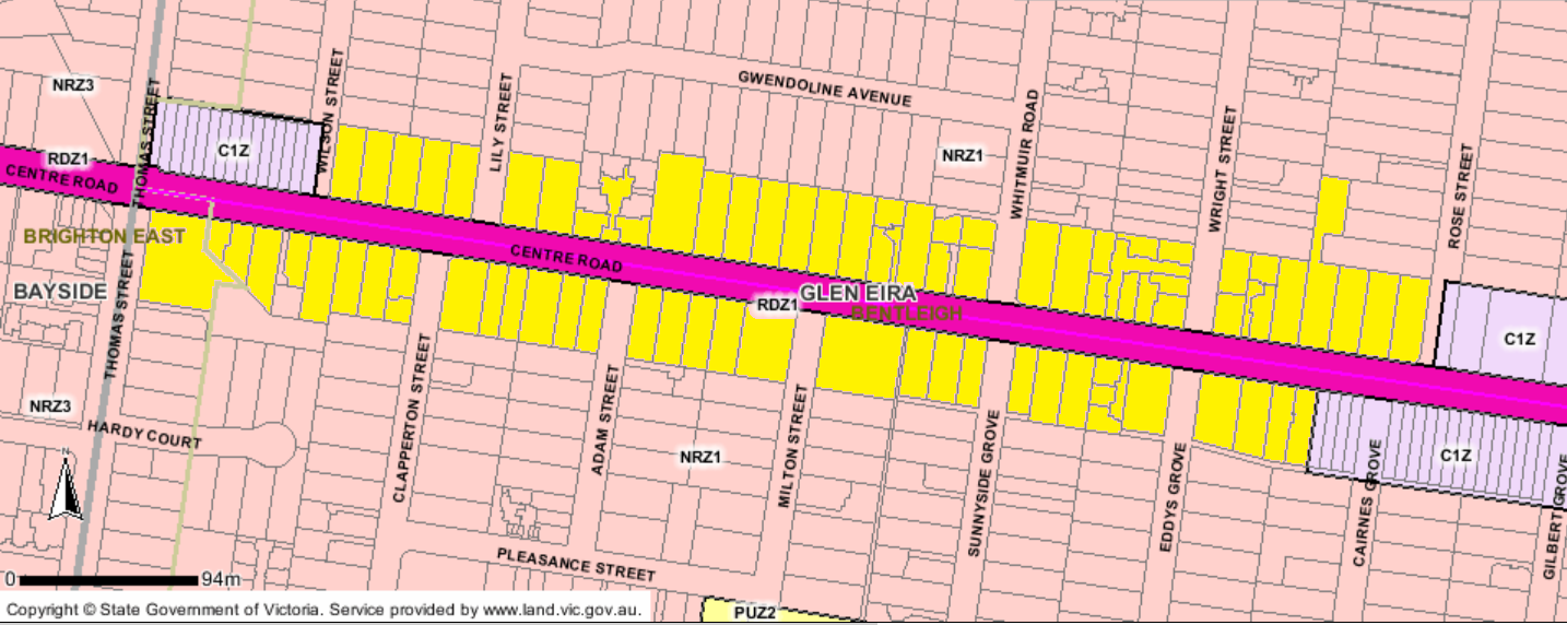
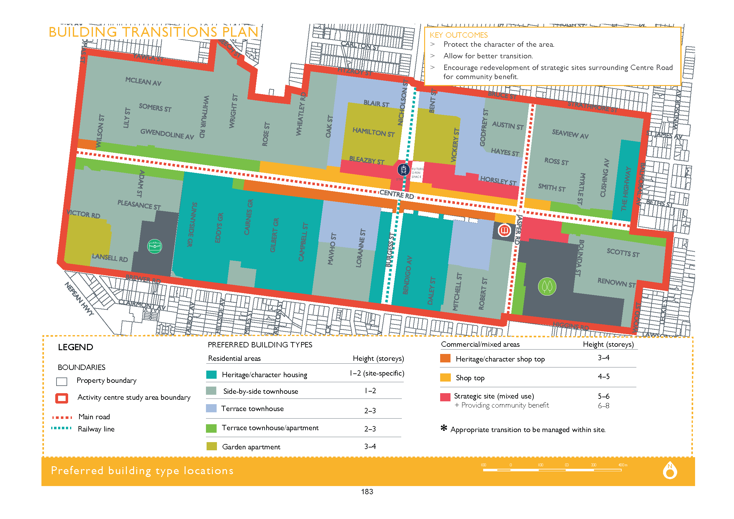
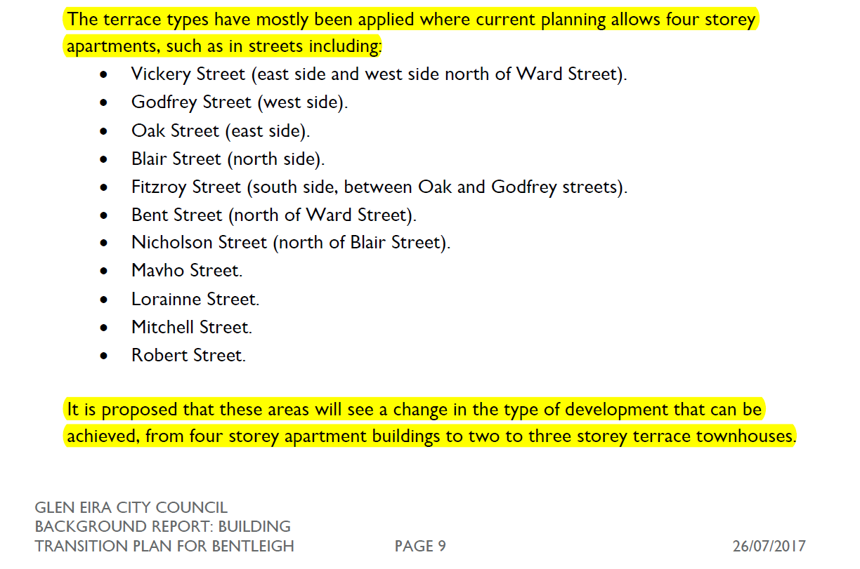
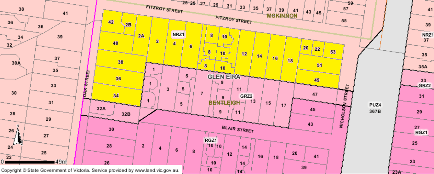
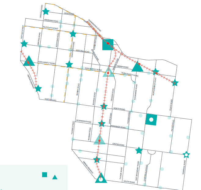
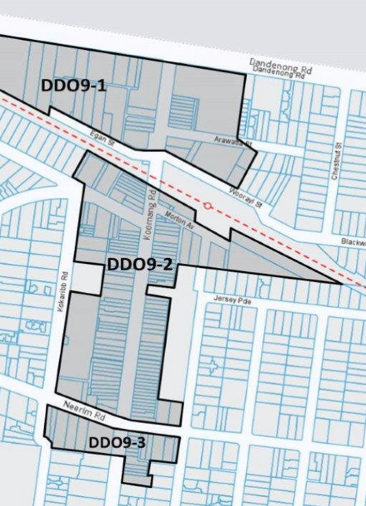
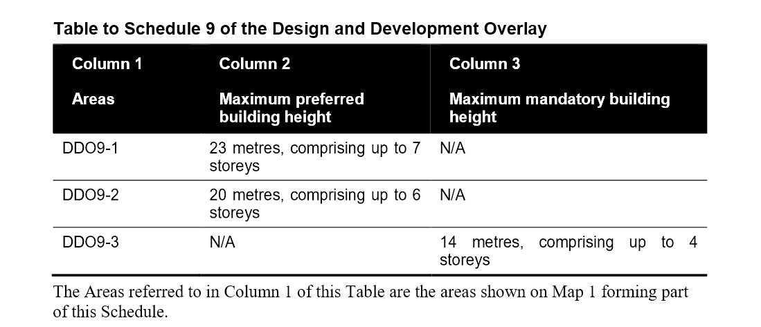
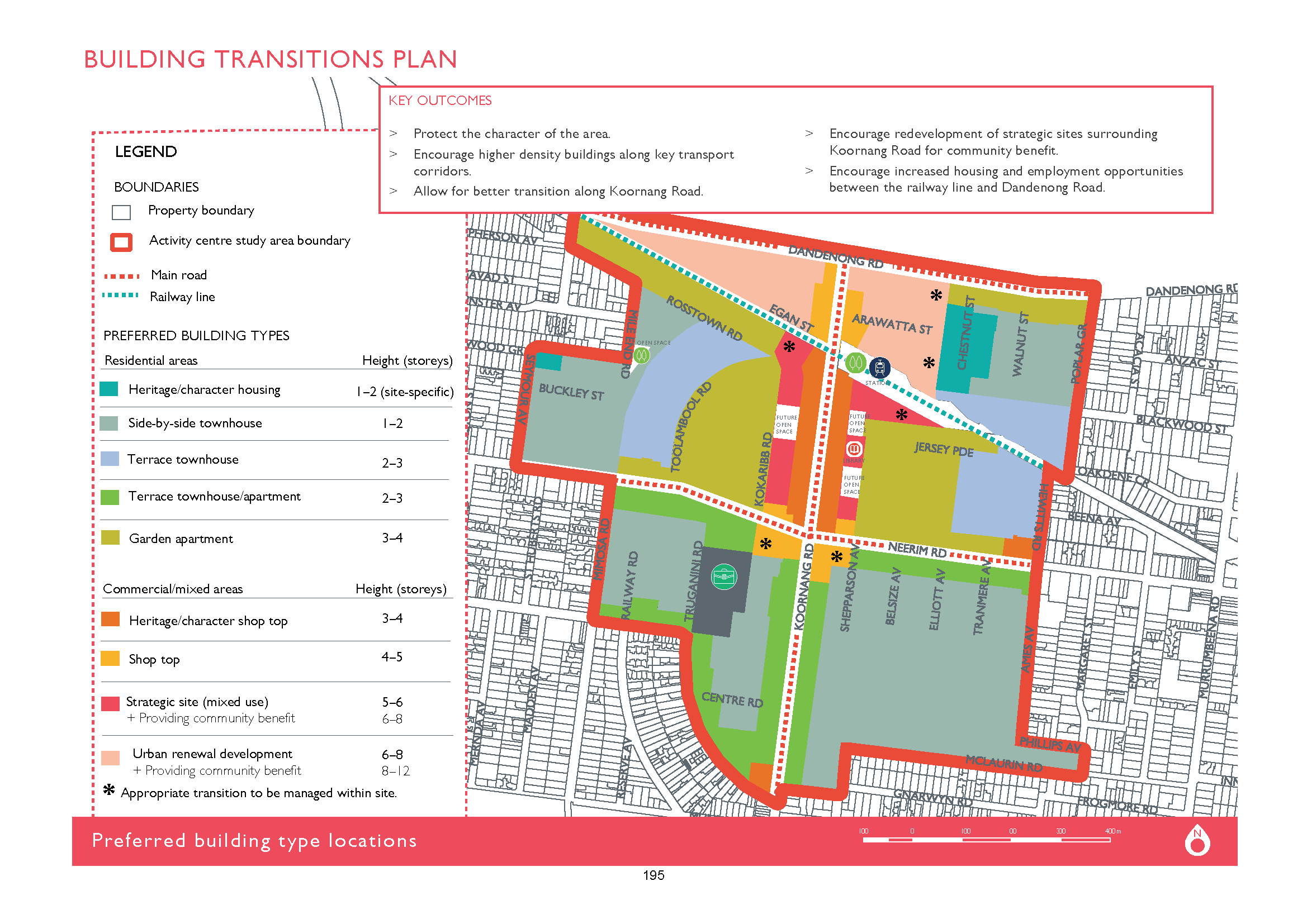
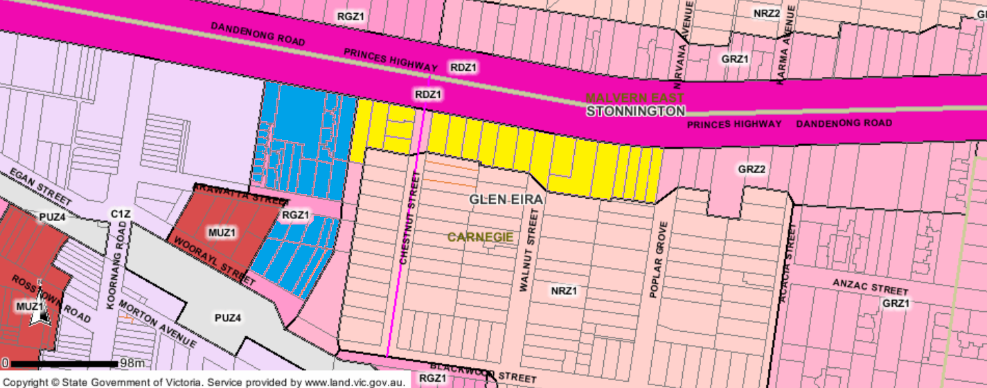
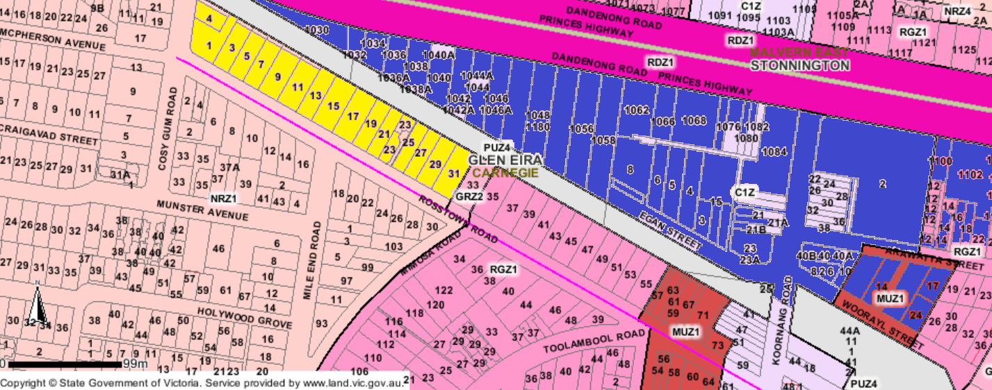
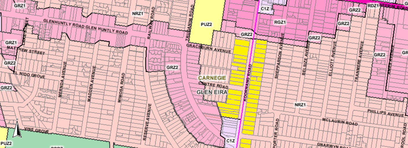
HYAMS: said there will be two more consultations and he is 100% sure there will be changes. Said there will be ‘concerns’ about 8 storeys in Bentleigh in the transition areas after ‘we’ve gone and said we want height protection’ so ‘there’s no doubt that will be controversial’. Said the question is whether ‘we think it is worth that’ to safeguard streets like Loranne and Mavho, Bendigo, Daley and Godfrey rather than looking at a ‘one size fits all in terms of geographic’ layout? We have to consider ‘whether we need to make that tradeoff’ or whether there is enough room for our ‘projected development’. Said these are ‘the questions’ that will come up. This is the same for the 3 storey proposals along Centre Road. That’s ‘also a quid pro quo’. In Elsternwick ‘should the strategic site go all the way to Hopetoun?’ or should it remain in ‘heritage shops as it is now’?
‘Overall, this does represent an improvement’. With these changes activity centres will be ‘more pedestrian friendly, more green space’. Agreed with Esakoff on parking. So ‘these are all things we need to look at when we get down to the detail’ because traders want parking for their clients. Thanked submitters thus far.
MAGEE: at the end of this council period there will be another 8000 new people living in Glen Eira and by 2027 there will be another 20,000 people. That ‘worries’ him about how to accommodate the new and the current residents. ‘How do we transition Bentleigh, East Bentleigh’ when it hits 160,000 people living in the city? Some residents have said that Glen Eira ‘has already got too many people’. So ‘put up a sign no vacancies – that will never happen’. ‘I welcome the people coming into Glen Eira’. ‘I want to see a Bentleigh that’s growing’. The plans are a ‘damn site better than what was there before’. In Mavho, you ‘could build a 4 storey on one side of the street and 3 storey building on the other’. ‘We have now got that consistency in there’. Said there are ‘obviously trade offs’ behind Hodgkins Reserve, ‘there’s a group of houses there’ that will be 3 storey and a ‘trade off in Centre Road’. ‘This gives us a lot more certainty’ and ‘what’s really exciting is the requirement for diverse housing’. Said that ‘this doesn’t frighten me’ at all and he ‘welcomes the opportunity’ because we are in a ‘great place like Bentleigh’ with a railway station and ‘lots of facilities’ and here is the ‘opportunity for people who cannot afford’ houses. Said that when he decides to move out he will build double storey town houses on his land and sell them ‘for as much as I can possibly get’. He can see himself living ‘near a Bentleigh, McKinnon or Poath Road railway station’. Said the document is a ‘step forward’ and that it has to ‘address the amount of people’ who will come to a city that ‘is growing evolving’ and becoming a ‘metropolis’. It ‘worries me that we’re not accommodating and looking far into the future’ but the ‘document is starting that process’.
SZTRAJT: said there would be different opinions. Said that he was elected as a councillor ‘to protect Glen Eira’. He ‘loves Glen Eira’ and lived ‘here most of my life’. ‘If it were up to me I would like all development to occur outside of Glen Eira’. Said he is ‘trying to restrict development in Glen Eira’. He views each application on ‘its merits’ but ‘overall’ ‘my vision’ would be a city that ‘halts a lot of this development’. His ‘problem’ though is that when not a councillor he got angry at council, and when they refused an application he got angry at VCAT for overturning council’s decisions. That’s why he decided to become a councillor. ‘So I am standing here conflicted’ because ‘I believe I’m standing here to protect what we have right now’ but ‘I’m smart enough to know’ that ‘wishing it’ is so is ‘not going to happen’. So ‘rather’ than letting development happen because of State Government imposed decisions, or VCAT’ developments are ‘happening’. The ‘problem’ is that development is ‘happening in a way that is unstructured’ and that the community does not ‘have control over it’. So if a development goes up next door and ‘we think it’s unfair’ then ‘we don’t have a leg to stand on’ if it goes to VCAT they don’t look at just Glen Eira, they are ‘looking at all of Victoria’. They say that ‘Glen Eira has to take its share’. ‘I think that Glen Eira is taking more than its share’ but that doesn’t mean that VCAT will agree with him. ‘So Glen Eira is going to have to grow’. ‘I would much prefer our community to be holding the rein’ by ‘making the decisions on what type of development we want to see’. Said there’s ‘plenty’ in the documents that he disagrees with and they have argued about it. But ‘this decision tonight is about saying ‘we want the community’ in on this. Said ‘we have to be honest’ and if development is happening then ‘let’s get ahead of them’. ‘This is the time we want community involvement’ because ‘we’ve got the chance to say this is how our city should look’. If council doesn’t say ‘where’ development should go it will be ‘imposed on us and will happen in residential side streets‘. Urged people to ‘support us in this by giving your feedback’.
TAYLOR: ‘genuinely and pleasantly surprised’ about ‘how clever’ this document is so that ‘instead’ of having development concentrated ‘down those smaller streets’ it will be ‘concentrated in our activity centres’ and ‘arterial roads and not so much’ in local streets. This will be more ‘palatable’ but she doesn’t want to be ‘presumptive’ so ‘let’s hand this document over to you’. On congestion ‘we will have the integrated transport plan’ that will ‘integrate into the structure plan’.
DELAHUNTY: two ‘massive pieces of work’, ‘very exciting concepts’, ‘controversial’. Said she can see ‘multi level car parking’ at the back of shops to ‘activitate’ the centres and ‘exactly what the traders were telling us they wanted’.
DAVEY: said this is a ‘strategic document’ and is a 15-20 year document. This will ‘change everything’ how people use the centres. ‘We don’t always agree’ but ‘ultimately it is not for us’ but the community’s views.
MOTION PUT AND PASSED UNANIMOUSLY
 Translated this means –


 What is proposed