GE Transport


Set down for decision Tuesday night is an application for a 6 storey building with 33 units, 6 shops, basement car parking and the waiver of parking spots for the shops and visitors, plus a loading bay. The site is along McKinnon Road between Wheatley and Jasper. The officer’s recommendation is to approve a permit.

We highlight this item for several reasons:

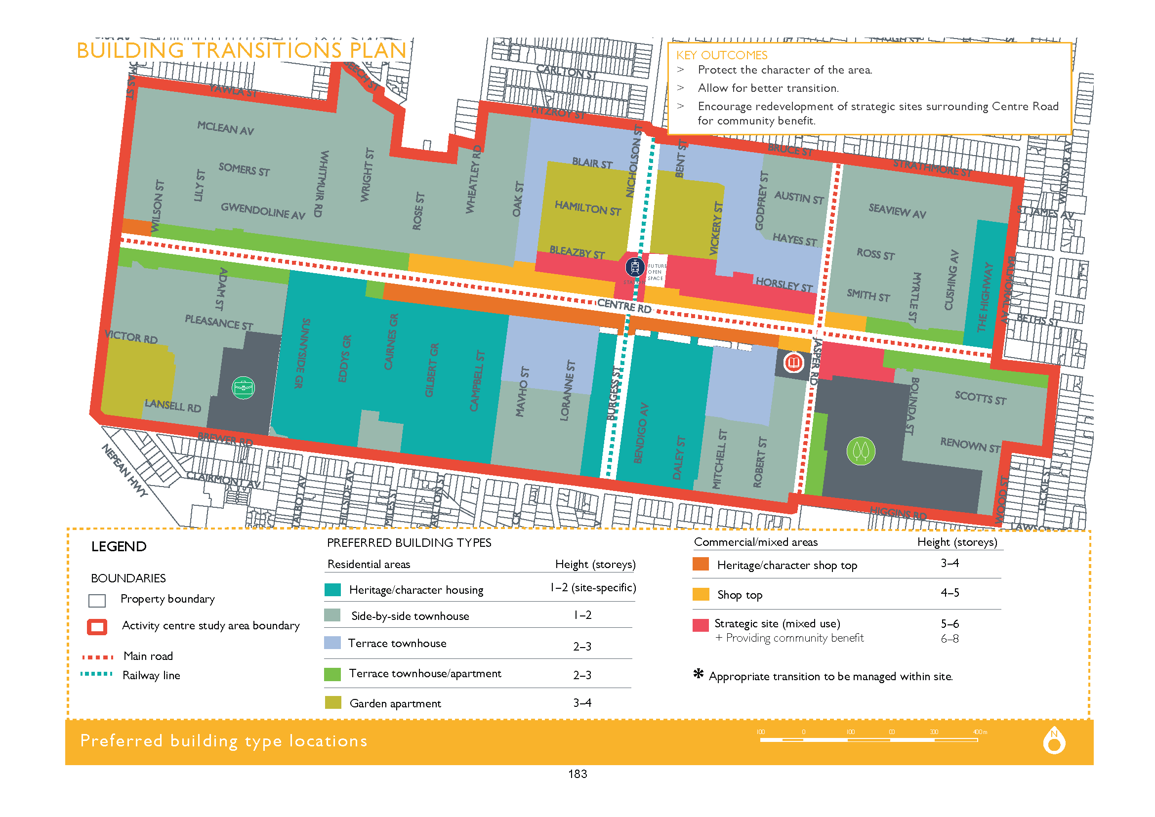
  • McKinnon is one of the smallest ‘neighbourhood centres’ – now officially an activity centre. Yet according to council’s planning scheme it sits well below its so called ‘urban villages’ of Bentleigh, Carnegie and Elsternwick. Thus we have the insanity of council’s application for height limits of 5 storeys in Bentleigh and now six storeys is viewed as acceptable in McKinnon!
  • Readers should also remember Amendment C143 where councillors changed an advertised amendment from Mixed Use Zone of 4 storeys in McKinnon Road, to a zoning of General Residential Zone (3 storeys) because they argued that 4 storeys was too much. Community opposition does work wonders!
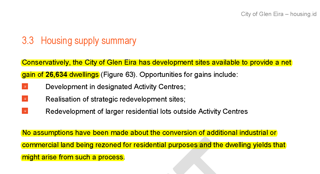
  • This application is supposed to have 6 shops ranging in size from 53 square metres to just over 90 square metres. McKinnon has no bank, no supermarket, no butchers, no fruit shops, no clothes shops, and nothing really except cafes and more cafes. How much employment will be generated by a 53 square space is debatable – especially since council’s consultants predict a decline in ‘retail’ of thousands by 2036.

We have commented time and again on the lack of transparency in council officer reports for applications. This report is no different –

  • Instead of highlighting the number of one bedroom, two bedroom apartments proposed, the report lumps together the number of 1 and 2 bedrooms so that it is impossible to determine the percentage of one bedroom compared to 3 bedrooms. Worse still is the inclusion of totally illegible plans. When council spends millions on IT systems, surely it can provide images that are capable of being read. Is this deliberate?
  • The application has a deficit of 9 car parking spaces for its shops and 2 spots for visitor car parking. The recommendations on shop parking are far from transparent when we get sentences such as – Given the location of the site and proximity to residential areas, it is recommended that all visitor car spaces (6), and at least two car spaces for each commercial space be provided onsite. What is not spelt out is that this only totals 12 parking spots when the legislation required 16. Thus a waiver of 4 spots and no mention of loading bay or any reason for this largesse!
  • The traffic department’s view is also bereft of justification. All we get is this single sentence – Transport Planning is satisfied with the number of customer car parking spaces that has been provided for the shops
  • The best however is to be found in this incredible paragraph that is meant to justify everything but which conflicts completely with the current planning scheme –

The proposal has an overall maximum height of 19.96 metres. While the proposal will undoubtedly be taller and more robust than adjoining existing development, it is considered that it represents what policy expects in terms of change given the size of the site, the emerging built form in the immediate area and its strategic location. 

Where in the planning scheme does ‘policy’ envisage buildings higher than the major activity centre of Bentleigh?

Where in this area is there another building of this height?

Why is it acceptable to have a six storey building towering over a three storey building at its rear, when council first refused a permit in Caulfield North because it was to be a mere 2 storeys higher than its surrounds?

Nor are we talking about a really huge site. It is barely 1150 square metres and of course is not mentioned anywhere in the report!

Nothing changes in Glen Eira’s pro-development agenda. Officer reports are abysmal, deliberately vague and most importantly either conflict with the planning scheme itself or provide practically nil justification for the final recommendations!


A very long post, but incredibly important.

Following months and months of public consultation on structure planning for Glen Eira’s activity centres we finally get the first glimpse of the ‘design guidelines’ for Bentleigh, Elsternwick and Carnegie and the ‘big picture’ for the other activity centres (neighbourhood centres).

Residents should be very, very alarmed with what is another nebulous and poorly explicated effort from Council. The only thing that is clear is that very little of what residents have stated they desire has been incorporated into these waffly documents. For example:

  • Height limits of 3 to 4 storeys, especially in ‘neighbourhood centres’ was stated time and again. It now is on the drawing board that suburbs such as McKinnon, Ormond, Bentleigh East,etc can expect buildings  much higher depending on zoning. Needless to say not one single word of justification is forthcoming as to why 8 or 12 storeys is warranted anywhere. Further, another item in the agenda recommends that a permit be granted for a 6 storey development in McKinnon Road, McKinnon. The rot has well and truly started for our neighbourhood centres!
  • Below is 2 examples of what we mean. Please read carefully

As for the major activity centres themselves we find the following:

  • There is still the intent to flog off public land for high rise commercial development
  • Multi storey car parks are still in the picture
  • Structure plans will NOT BE forthcoming by December 2017
  • Parking plans still belong to the ‘never-never’
  • Heritage is ‘expendable’ and dependent on where it is – ie it is okay for 3 and 4 storeys in heritage overlays
  • The only potential concession to heritage from Bentleigh is the Bendigo & Daley Streets overlay (which is zoned Residential Growth Zone). Given that the map below is shaded green but also includes the ‘site specific’ addendum, we have no idea whether this means these streets will be rezoned to 1 or 2 storeys, or whether 3 and 4 storeys are still on the cards.
  • The red areas identified as ‘strategic site’ and given the green light for between 5 and 8 storeys are a major worry since they abut areas zoned General Residential – ie 3 storeys.

Conclusions

  • It is obvious that council is gearing up for more and more development. These plans are merely facilitating this process and totalling ignoring the vast majority of community feedback.
  • There is no intention of reviewing the zones – only expanding the borders of the activity centres.
  • No real strategic justification exists for any of the height recommendations
  • Census figures are available, yet these documents are still touting 2011 figures!
  • Urban design as carried out by every other single council contains information on setbacks etc. This is non existent in these documents.
  • Residents are being drowned in paper. That is undoubtedly the intention we believe. To provide not information, but dribs and drabs that are near impossible to decipher. There can be absolutely no excuse for the lack of proper legends, clear and precise images, and language that actually is more than spin and useless jargon.

We will comment in greater detail in the days ahead.

PS: We forgot to mention that readers need to pay careful attention to those areas now marked as light green and orange. In the current planning scheme these sites are zoned as NRZ (ie 2 storeys). They have now been given the ‘green light’ for 3 storeys. Also, the section at the corner of Brewer and Thomas Street is now earmarked for 4 storeys from its previous 2 storey height limit. Please also remember that only a short while ago a public question asked council whether they intend to rezone any NRZ sites to GRZ or RGZ. These documents provide plenty of evidence that countless properties will now become 3 or 4 storeys and possibly even higher. We do not believe that council wasn’t aware of this at the time of their ‘response’ – since it definitely wasn’t an ‘answer’ to the public question.

Council has published the Terms of Reference for its Community Advisory Group for the East Village project. Ostensibly, the creation of this advisory committee is a positive step, if somewhat belated in that the first draft of the resulting structure plan has already been set.

What concerns us even more than the question of timing,  is how  transparently this committee will operate, how it will report,  and how much notice will be taken of community rep views. The terms of reference (see below) do not fill us with confidence that this will be anything except another public relations exercise designed to provide the illusion of working with the community.

Please note the following:

  • No mention is made of councillors. Are they excluded entirely from any involvement in this committee – from selecting residents to actually partaking in the meetings?
  • Why is all responsibility granted to officers in terms of selection, etc?
  • Why is there no formal council resolution that endorses these terms of reference?
  • Why is there no mention of reporting requirements to the wider community?
  • Why is there the possibility that the Victorian Planning Authority and others may attend, when it was specifically stated by the Mayor that this is a committee expressly set up to work exclusively with council?
  • Given that the next iteration of the structure planning work is supposed to be in July (ie urban design/building guidelines) then how many times will this committee actually meet?

Council has published its ‘draft’ Structure Plan for the development of Virginia Estate. It has also announced that in the next few weeks it will be calling for expressions of interest for residents to partake in a Community Reference Group. A tad too late we suggest since the ‘draft’ has already been formulated and given past experience very little is likely to change.

The only ‘improvement’ that is clear is the statement that a 1 hectare public open space will be included. Issues regarding schools and transport are still being ‘negotiated’ with the State Government.

The most disturbing aspect of this ‘draft’ Structure Plan is that council’s nominated height limits are in fact even higher than the proposals from the developers. We’ve uploaded the Gillon & Co draft plan as well as the Council nominated version below. Please compare carefully!

No information is forthcoming as to potential number of residential developments, the number(s) and area of retail, etc. More to follow in the days ahead on this item.

PS: Council claims that the above draft is in response to community feedback thus far. At the May forum we reported that residents stated the following:

  • Problem with language – people did not know what ‘innovation’ referred to – far too vague.
  • More clarity required about the term ‘affordable housing’ and this should be changed to ‘diversity of housing’
  • Questions about what ‘village’ means and is this a ‘village’
  • Traffic and car parking are major problems
  • Desire for low rise townhouses. Some tables nominated a maximum height limit of 3 storeys and others up to 6 storeys.
  • Diverse views on the need for another school and whether this should be part of McKinnon High or another new school entirely.
  • Open space that wasn’t covered over in concrete
  • A new supermarket required but also not a threat to other existing businesses in the area.
  • No waiving of car parking spots
  • Environmental sustainability across the entire centre including flood mitigation

Council has now decided to amend the ‘vision’ statement. It remains full of gobbledy gook, and DOES NOT address the responses listed above. Below is the original ‘vision’ and then the latest updated version.

East Village will be a thriving, mixed use precinct with a focus on employment, innovation, education and housing affordability. (Version 1)

‘East Village will be a sustainable mixed use precinct with a focus on innovative employment and education opportunities. Enhanced by green spaces and places for people, it will be supported by a diverse range of high quality housing and retail that caters for all.’  (Version 2)

The most important page that has thus far been published by council is the following because it provides a clue as to what council is really planning and why residents across Glen Eira should be very, very concerned. Our take is that council intends to facilitate and expand development across Glen Eira – especially in those areas which happen to be close to railway stations and along major roads.

The Draft Activity Centre, Housing and Local Economy Strategy makes this absolutely clear. Here is the relevant screen dump  (page 10).  Please note the following:

  • At least 3 current Local Centres will be upgraded to Neighbourhood Centres – Patterson, Ripponlea, and Garden Vale. That means more apartments!
  • Moorabbin which is a current Neighbourhood Centre will now be a Major Activity Centre as will Glen Huntly (we acknowledge that the latter has always been seen by the Government as a Major Centre. Council has insisted on calling it a Neighbourhood Centre).
  • Caulfield and Virginia Estate are givens – just the amount of residential development is unclear. We estimate another 5000 dwellings at least on these two sites.

Council has refused to deny the possibility that properties currently zoned Neighbourhood Residential will suddenly find themselves zoned as General Residential or Residential Growth. Or those zoned as General Residential will be ‘upgraded’ to Residential Growth. Without a straight out denial, that convinces us even more that the probability of this occurring is already set in concrete. The question is how many homes will be affected? How many residents will wake up one morning to find that they can now have 11 and 13.5 metre dwellings (at best) right next door to them?

As an example of what currently exists we use Patterson as a model. Here is a map of this currently designated Local Centre. Please note that it consists of a handful of shops zoned Commercial 1, but surrounded entirely by sites zoned Neighbourhood Residential. Activity centres by definition include Neighbourhood Centres and every single activity centre contains sites zoned as either Commercial, Mixed Use, General Residential or Residential Growth Zone. They do NOT contain properties zoned Neighbourhood Residential – especially not in Glen Eira.

It is definitely time that council for once provided residents with a clear and truthful version of what is in store. A simple, unequivocal ‘no’ to our suggestion that countless properties will be rezoned to GRZ or RGZ would alleviate much angst.

We have received several emails asking us to elaborate on our statement that council will be enlarging the activity centres and thus paving the way for more intense development throughout Glen Eira. This post explains our reasoning.

According to the planning scheme the ‘housing diversity’ areas include all those sites zoned as General Residential Zone, Residential Growth Zone, Commercial and Mixed Use. NO NEIGHBOURHOOD RESIDENTIAL ZONING (NRZ) IS INCLUDED IN HOUSING DIVERSITY. These come under the umbrella of ‘minimal change’ – ie the NRZ zones.The image below makes this clear

Thus we have the current situation where each and every ‘activity centre’ is zoned as either RGZ, GRZ, C1Z OR MUZ. Where these sites meet ‘minimal change’ (ie NRZ) then that determines the border of the respective activity centre.

If we are to believe what is written in council’s commissioned housing report, then all this is about to change. Here are a couple of screen dumps from this document which refer to NRZ sites WITHIN ACTIVITY CENTRES! As we’ve stated – there are no NRZ sites in any activity centre. The fact that this ‘research’ is done on this basis can only mean one thing in our view – council will be extending the borders to most activity centres. And once extended we would bet that the classification of these sites will not be NRZ any longer!

Isn’t it about time that council came clean on what it is really doing? How much longer will residents be kept in the dark? And how about council answering the most basic questions concerning:

  • definite time lines
  • what is ‘capacity’ and why do we even contemplate the need for another 20,000+ dwellings?
  • how sustainable is any of this?
  • what is council doing about parking and traffic management?
  • what is council doing right now about amending the schedules to the zones?
  • why can other councils keep working on amendment after amendment and council has done bugger all, except to rezone land for more development?

There can be no doubt that council is gearing up for:

  • Facilitating increased major development throughout Glen Eira
  • Expanding the borders of activity centres

Residents need to question why given:

  • That Glen Eira is already the third most densely populated municipality in the state – only behind Melbourne and Port Phillip – both of which are special cases anyway.
  • That no estimates of infrastructure costs, traffic management costs, etc. have been included in any forecasts
  • No realistic estimates of what Wynne’s new legislation will mean for accelerated development in both Neighbourhood Residential Zones and the General Residential zones. The housing paper we believe fails to adequately account for these changes and their potential for much more development.
  • No realistic estimates of what demands will be placed on open space and how much meeting the most minimalist standards will cost
  • No consultation with residents as to whether or not they are accepting that various activity centres should be able to have a dwelling ratio of over 200 dwellings per hectare! A hectare is 10,000 square metres. If we assume that the average housing block is 500 square metres, this means that 20 houses will be replaced by over 200 in countless residential streets.

Featured below is the more detailed prognosis for our suburbs from council’s commissioned report –

Carnegie – Assumed 36% of developable land in the centre for future residential development of at least 200 dwellings per hectare.

Caulfield Junction (inc. Caulfield Village) – …. it is assumed that 36% of developable land in the centre for future residential development of at least 200 dwellings per hectare.

Elsternwick – development. Assumed 36% of developable land in the centre for future residential development of at least 150 dwellings per hectare.

Bentleigh – Assumed 28% of developable land in the centre for future residential development of at least 150 dwellings per hectare.

Moorabbin – Assumed 28% of developable land in and around the centre for future residential development of at least 150 dwellings per hectare

Murrumbeena – Assumed 28% of developable land in and around the centre for future residential development of at least 150 dwellings per hectare

Caulfield South – Assumed 28% of developable land in and around the centre for future residential development of at least 100 dwellings per hectare.

Glen Huntly – Assumed 28% of developable land in and around the centre for future residential development of at least 100 dwellings per hectare.

Caulfield Park – Assumed 28% of developable land in and around the centre for future residential development of at least 100 dwellings per hectare.

Hughesdale – Assumed 24% of developable land in and around the centre for future residential development of at least 100 dwellings per hectare.

McKinnon –  Assumed 24% of developable land in and around the centre for future residential development of at least 100 dwellings per hectare.

Ormond – Assumed 24% of developable land in and around the centre for future residential development of at least 100 dwellings per hectare.

Ripponlea – Assumed 20% of developable land in and around the centre for future residential development of at least 75 dwellings per hectare.

Gardenvale –  Assumed 20% of developable land in and around the centre for future residential development of at least 75 dwellings per hectare.

Alma Village – Assumed 20% of developable land in and around the centre for future residential development of at least 75 dwellings per hectare.

Patterson –  Assumed 20% of developable land in and around the centre for future residential development of at least 75 dwellings per hectare.

East Bentleigh –  Assumed 16% of developable land in and around the centre for future residential development of at least 75 dwellings per hectare.

We urge all residents to read the Housing commissioned paper and to digest its message. (UPLOADED HERE). Query the assumptions! Query the figures and finally query the (secret) agenda! We will be doing this in future posts.

There was a very, very good turnout at tonight’s forum. We estimate approximately 85-90 residents. Also in attendance was Mr Steve Dunn acting CEO of the VPA (Victorian Planning Authority) and some of his colleagues.

The evening was again facilitated by Ms Nathan. Following her introduction which assured residents that nothing was ‘set in concrete’ and that everything was on the table, Aiden Mullen from council presented the results of the previous survey and council’s plans for further community input. This was followed by Mr Dunn’s presentation where he outlined the role of the Victorian Planning Authority and also provided overheads of the work they have done thus far – eg. several projects in Bundoora (3000 dwellings on a 104 hectare site and another one (Polaris) which has 1100 dwellings on 12 hectares). Interestingly all the slides of development presented by both Mr Mullen and Mr Dunn did not show any buildings of higher than 4 or 5 storeys for the latter and 3 storeys by council!

The audience was then asked to discuss at their tables the ‘vision statement’ and to answer the following questions:

VISION STATEMENTEast Village will be a thriving, mixed use precinct with a focus on employment, innovation, education and housing affordability

THE QUESTIONSDo you agree with the vision? How would you change it? What would the table’s vision be? (10 minutes).

What are the tables 3 priorities to include in the structure plan in order to achieve this vision? And how?

RESPONSES

Each table then reported back to the entire audience on their discussions. We summarise the major points below:

  • Problem with language – people did not know what ‘innovation’ referred to – far too vague.
  • More clarity required about the term ‘affordable housing’ and this should be changed to ‘diversity of housing’
  • Questions about what ‘village’ means and is this a ‘village’
  • Traffic and car parking are major problems
  • Desire for low rise townhouses. Some tables nominated a maximum height limit of 3 storeys and others up to 6 storeys.
  • Diverse views on the need for another school and whether this should be part of McKinnon High or another new school entirely.
  • Open space that wasn’t covered over in concrete
  • A new supermarket required but also not a threat to other existing businesses in the area.
  • No waiving of car parking spots
  • Environmental sustainability across the entire centre including flood mitigation

COMMENTS

How useful an evening like this has been remains to be seen of course. It will largely depend on how many of the above comments find their way into the final structure plan. In other words to what extent is government, council and the developer listening to the locals? Will we have maximum height limits of 3, 4, or 5 storeys? Will we have open space that is more than a ‘village square’ surrounded by high rise? Will we have 2, 3, or 4000 apartments and only a handful will be categorised as ‘affordable/social housing’? Will the traffic mayhem of North and East Boundary Roads be fixed by appropriate infrastructure? Will an entire new school really happen and how big will it be? Will retail offer fair dinkum employment opportunities or are we going to get employment as slave labour (ie kids) working for McDonalds and supermarket check out staff? What carrots will be dangled in front of major companies to come to Virginia Estate and will this cost ratepayers anything? What is the appropriate percentage mix of retail, to housing, to industry/offices – 50/50? 70/30? Who decides – the market, council, state government?

There are literally a myriad of unanswered questions and in our view a vision statement as presented above does not clarify anything. The questions that go with the vision statement are also far from ‘objective’. They are there to simply endorse the ‘vision’ rather than to really elicit knowledgeable commentary from residents.

PS: not one councillor was in attendance that we saw!

PPS: it has now been months since talk of establishing a ‘community reference group’ to work with council on the East Village project. Thus far – silence! Will this group eventuate and if so will it be when all the planks have already been set in stone?

Council is wonderful in producing stats that sound scary and ostensibly support their case. More often than not, these stats tell only half the story. For example this paragraph from the Activity Centre Strategy  –

State Government statistics indicate that over the last five years (2011–2016), Glen Eira has experienced significant change with a population increase of 11,233 and 4,300 new dwellings constructed (page 147)

Or this effort –

Recent statistics released by State Government (Victoria in Future 2016) indicate that Glen Eira’s population is likely to increase by a further 15 per cent over the next 15 years, resulting in the need for an additional 9,000 dwellings.(page 159 and repeated in the glossy section at page 22).

So exactly what do these figures mean? 9000 new dwellings sounds like a hell of a lot and is meant to – but this is over a projected 15 year period. Hence all Glen Eira requires to meet its population growth according to these figures is a measly 600 net new dwellings per year! Hardly enough to justify the strategy and its ambition to hand over more and more land to developers.

Nor do these figures take into account what has been happening in Glen Eira for the past 5 to 6 years. Australian Bureau of Statistics data on building approvals provides a window into the rampant development that has already occurred. Building approvals are development applications that have already received their permits and have been given the green light to begin construction. Here are the ABS figures for new dwellings –

2011/12 – 912

2012/13 – 957

2013/14 – 1,231

2014/15 – 1,786

2015/16 – 1,680

2016/17 – 1520 (end of March 2017)

TOTAL – 8086

This figure of 8086 new dwellings DOES NOT INCLUDE:

  • The 1200+ new dwellings for Caulfield Village which have already been granted their ‘permits’ via the approved Incorporated Plan and various Development Plans
  • Another, 2000, 3000, 4000(?) potential apartments for Virginia Estate.
  • Nor does this figure of 8086 include all the permits which have been granted but are yet to be taken up and construction started (and hence are still awaiting their building permits)
  • Set down for decision Tuesday night, we get the recommendation for another 87 new dwellings! The meeting before, 18 new dwellings plus refusal for 169 which will end up at VCAT and in all likelihood get at least half of this number. These would not have been added to building or planning permit state registers as yet. Thus, in two council meetings we have just under another 200 net new dwellings in Glen Eira. Go back a couple of more council meetings and the picture is the same.

So what is the take home message for residents?

  • At the current rate of development, Glen Eira will be able to cater for projected population growth NOT IN 2031 BUT BY 2021!
  • 600 net new dwellings is the required ‘quota’ per year according to all recent projections. Glen Eira is averaging close to triple this amount per year.
  • Given the above, WHY IS THIS STRATEGY DETERMINED TO INCREASE DEVELOPMENT AND WHY THE SECRECY ON HOW RESIDENTIAL AMENITY IS TO BE PROTECTED?

By way of summary, here is what the strategy wants to happen in order to facilitate further development. This may sound innocuous and to be merely repeating the current mantra of housing diversity versus minimal change and thus directing development to ‘appropriate’ spots. It is the extent of expansion, the vague references to ‘strategic sites’ plus ‘arterial roads’ and the upgrading of local centres to neighbourhood centres, or neighbourhood centres to major activity centres that is the concern.

CLICK TO ENLARGE – Couldn’t council have produced a far more legible document that could be read clearly without the need for a magnifying glass?

Council has finally released its draft Activity Centre Strategy. We are left speechless at both the quality and the deliberate camouflage of council’s intentions. Not only is the document a vapid, repetitious , and totally uninformative vision of the future but it lacks everything that an Activity Centre Strategy should include. For example:

  • No detail on proposed height limits
  • No detail on proposed building form
  • No detail on proposed open space requirements
  • No definition as to what ‘urban renewal’ really means
  • Plenty of promises that largely repeat the promises made in 2003/4 but without any timelines
  • Statistics that are wrong, wrong, wrong!

Worse still is the tone! Lack of detail is one thing, but when a strategic document of this importance includes the following rubbish it is totally unacceptable. We quote directly from the strategy and invite ‘interpretations’ as to the true meaning of any of these sentences –

As our local centres become more affected by globalised and mobilised markets, it becomes more and more important to create community rich experiences within these centres that cannot be bought online

Explore opportunities to facilitate local flexible working opportunities such as co-working spaces or expanded library areas.

Strategically locate future parcel pick-up stations and other digital transactions facilities within activity centres that encourage community interaction

Strengthen the heart of the community

Foster ‘bottom-up’ change through a focus on place-making.

Ensure key community needs are provided in each centre (such as banks, post office, grocers, butchers and bakers). (Please remember that council has no control over banks, post offices, nor private retail!!!)

Housing capacity and building scale can be separated from activity centre hierarchy by clearly identifying housing typologies that can accommodate growth in strategic locations that respond to their immediate context and neighbourhood character, and also reduce impacts on amenity.

We also have succinct vision statements for each centre that belong to the world of Forrest Gump or the Wizard of Oz, rather than a local government strategic document. Here is the ‘summary’

We acknowledge that Plan Melbourne has foisted some conditions onto council – ie Caulfield Junction as a Major Activity Centre, plus Moorabbin, etc. However, this does not excuse the production of a document that is full of meaningless waffle and motherhood statements, plus similar promises to what has been made and not been acted upon in the past 15 years! It is surely time that council comes clean and informs its residents in a straight forward and honest manner exactly what it proposes! We would also welcome a submission period of longer than the 3 weeks indicated.

Finally, by way of contrast, we have to again bemoan the fact why  other councils can do things so much better and with so much more clarity, and dare way say, honesty! Here are a couple of Activity Centre Strategies from other councils. Please compare and contrast!

STONNINGTON – UPLOADED HERE

MORELAND – UPLOADED HERE

« Previous PageNext Page »