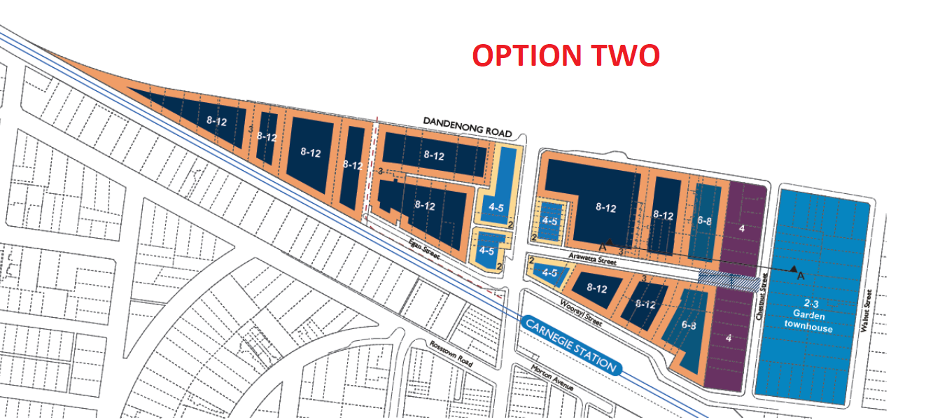
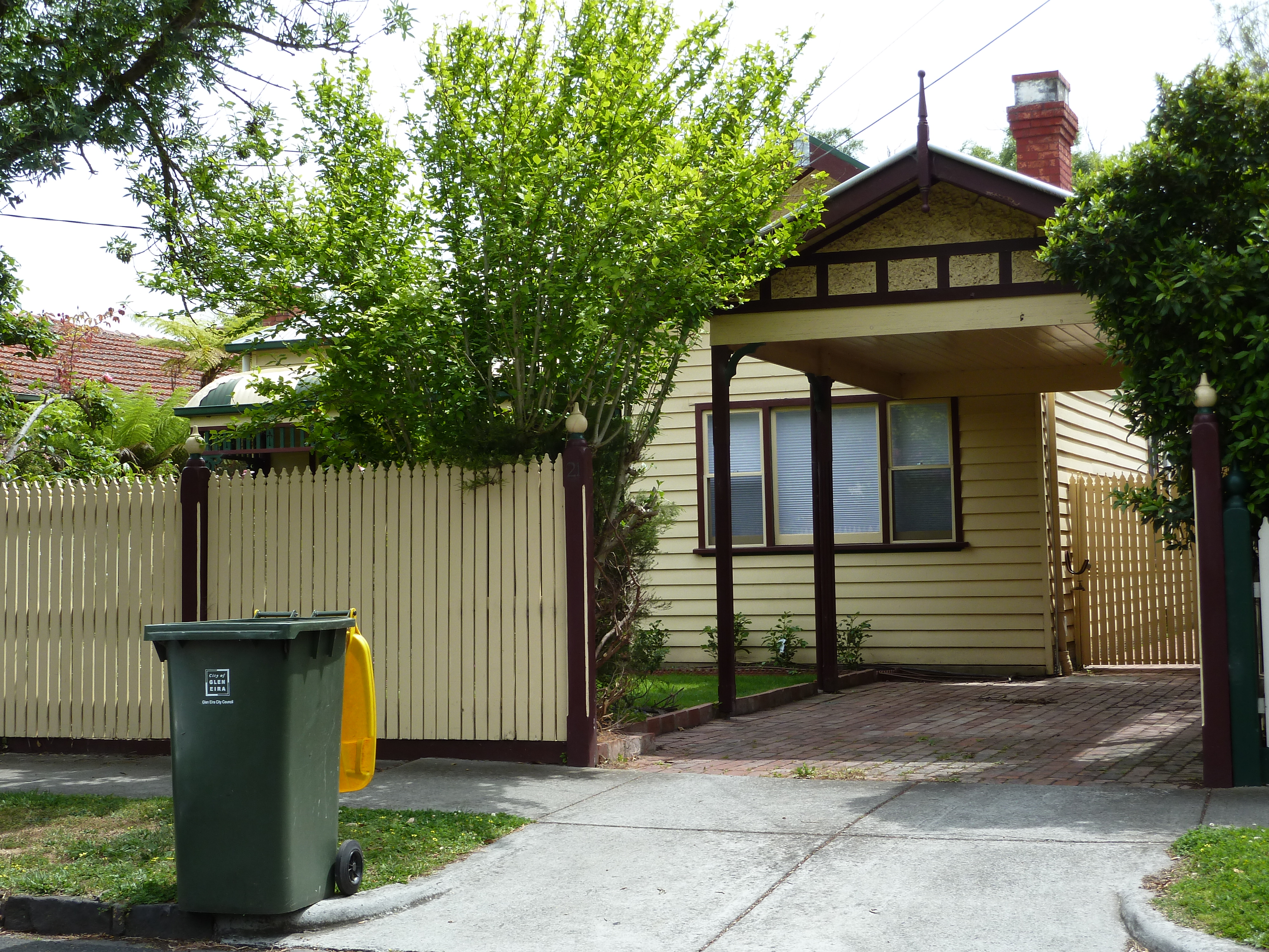
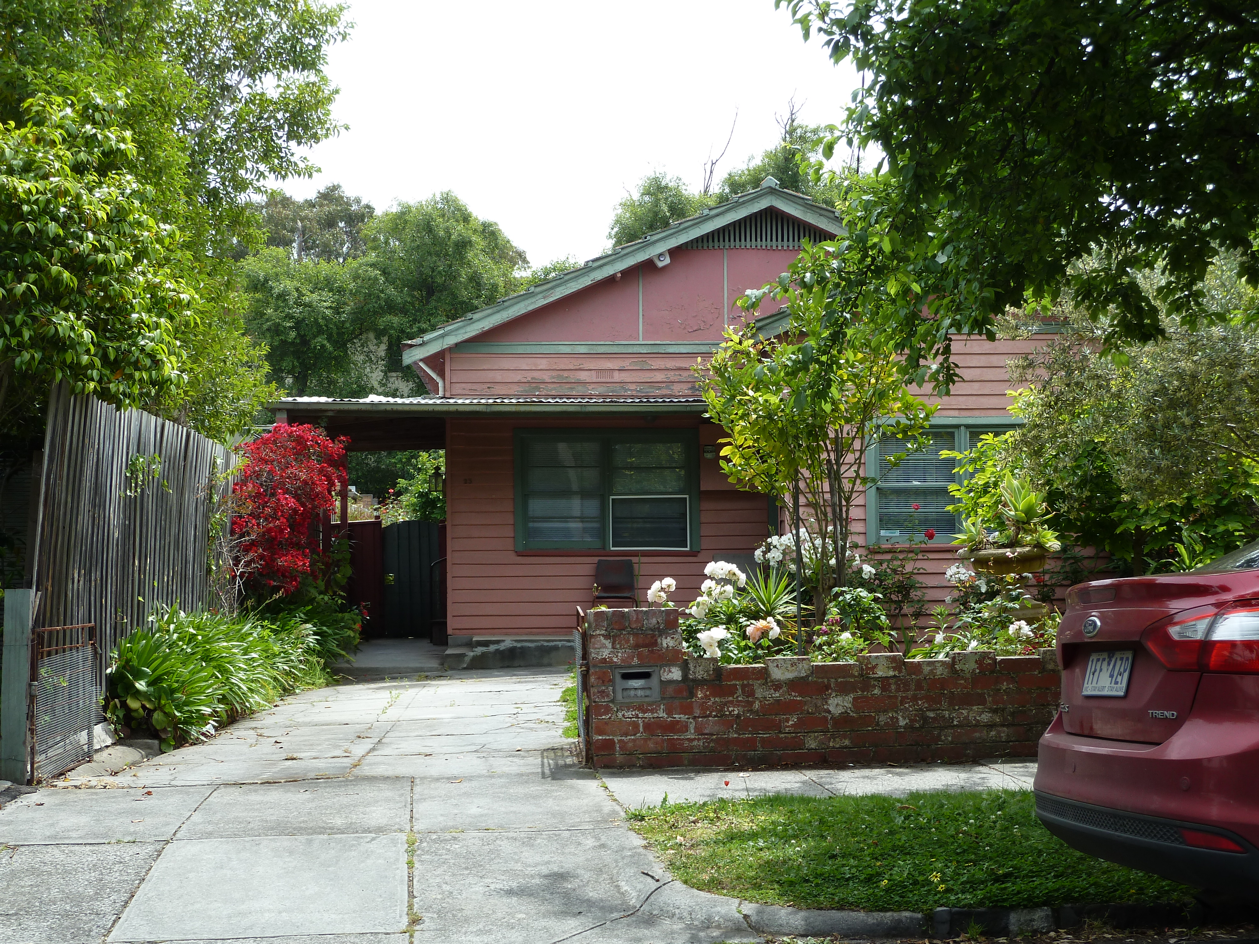
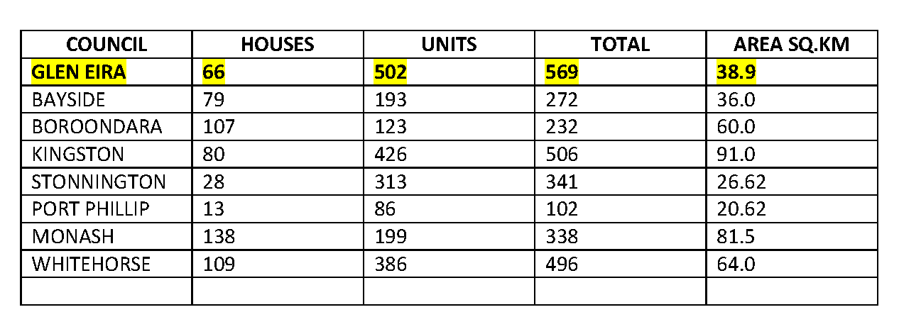
Today’s published report by the ANU confirms what many residents already know but which our council, hell bent on facilitating more and more (expensive) development, refuses to acknowledge much less accept. As a further example of what’s happening in Glen Eira, the state government’s Planning Permit Activity report for the single month of October has Glen Eira providing permits for another 248 NET NEW DWELLINGS!
Here is the ABC’s report on the ANU study –
House prices based on undersupply myth, ANU says
By business reporter Michael Janda
Australia does not have a housing shortage, with inner-city areas of Sydney, Melbourne and Brisbane some of the nation’s most oversupplied regions, according to new research from ANU.
Key points:
- Australia has built 164,000 more dwellings than it needs to cater for a growing population
- Inner-city areas in Australia’s three biggest cities have the greatest oversupply
- Outer suburban areas and central Adelaide had some of the most significant housing shortages
The analysis estimates the nation’s housing oversupply at 164,000, or 32,000 if the significant increase in unoccupied dwellings is excluded.
The study by associate professor Ben Phillips and researcher Cukkoo Joseph from the Australian National University shows that between 2001 and 2017 Australia built more homes than it needed to house the growth in population over that period.
The academics’ findings tally with other recent research showing that Australia has a moderate housing oversupply.
However, this research used a relatively sophisticated methodology that accounted for demographic changes.
Additionally, it accounted for an increase in people residing in “non-private dwellings” — such as student accommodation or nursing homes — that are often excluded from housing supply-demand analyses and tend to exaggerate an apparent housing shortage.
This report has also gone below state-level analysis to regional calculations.
It found that the inner-city area of Sydney had the nation’s largest housing oversupply, at just under 6,000 dwellings.
That was in contrast to areas in the mid and far-west of Sydney, which generally had moderate undersupply, as did Wyong on the Central Coast.
Inner-Brisbane had the nation’s second largest oversupply of around 4,500.
Melbourne CBD and surrounds had the fourth highest oversupply of just under 4,000 excess dwellings.
Outside the inner-urban areas, where oversupply was mainly driven by the nation’s record high-rise apartment boom, the other main areas of oversupply were in regional areas, particularly those exposed to the resources sector where the mining downturn has caused populations to shrink.
While these mining areas had generally witnessed large property price falls, Mr Phillips said some of the other oversupplied areas had actually experienced strong price growth.
“We haven’t found a particularly strong relationship between the balance of supply and demand and house price growth,” he told the ABC.
“We did find a very small correlation, but it was less than 10 per cent, so what that tells us is that there is perhaps some impact from housing supply but, by and large, what’s driving house prices in Australia, particularly in our capital cities, is a whole range of other factors.”
Housing boom story ‘falls over’ in light of oversupply
The significance of this finding is that increasing housing supply by itself is unlikely to put significant downward pressure on prices.
Given that increasing supply has been the almost exclusive housing affordability focus of the current Federal Government and most of its state counterparts, Dr Phillips said it is no surprise that affordability has not improved.
“What this research shows is that that’s not necessarily going to be as helpful as what many would hope,” he said.
“Perhaps what it actually means is that we should be focussing our attention more on the demand side of the equation.”
Mr Phillips said that means looking at whether interest rates have been too low for too long, and also reviewing “generous” tax breaks for property investors, such as negative gearing and the 50 per cent capital gains tax discount.
There’s been an important assumption that’s been made – not just by the Reserve Bank but also by government in general – and that is that to a certain extent low interest rates are justified in Australia, and the impact on house prices is justified, because we’ve got a so-called housing shortage,” he said.
“That supports house prices growing, it suggests there are fundamentals that are driving house price markets, so it’s not necessarily loose monetary policy that’s driving that.
“But, if our findings are correct in that actually we’ve got a housing surplus, then that argument does actually fall down somewhat.
“It is concerning that without the housing shortage you don’t actually have a lot of basis for the house price growth.”
Although, Mr Phillips also pointed out that Australia’s housing surplus was much smaller than markets such as Ireland and Spain that experienced dramatic home price collapses during the global financial crisis.
Source: http://www.abc.net.au/news/2017-11-20/house-price-growth-based-on-undersupply-myth-anu/9167688

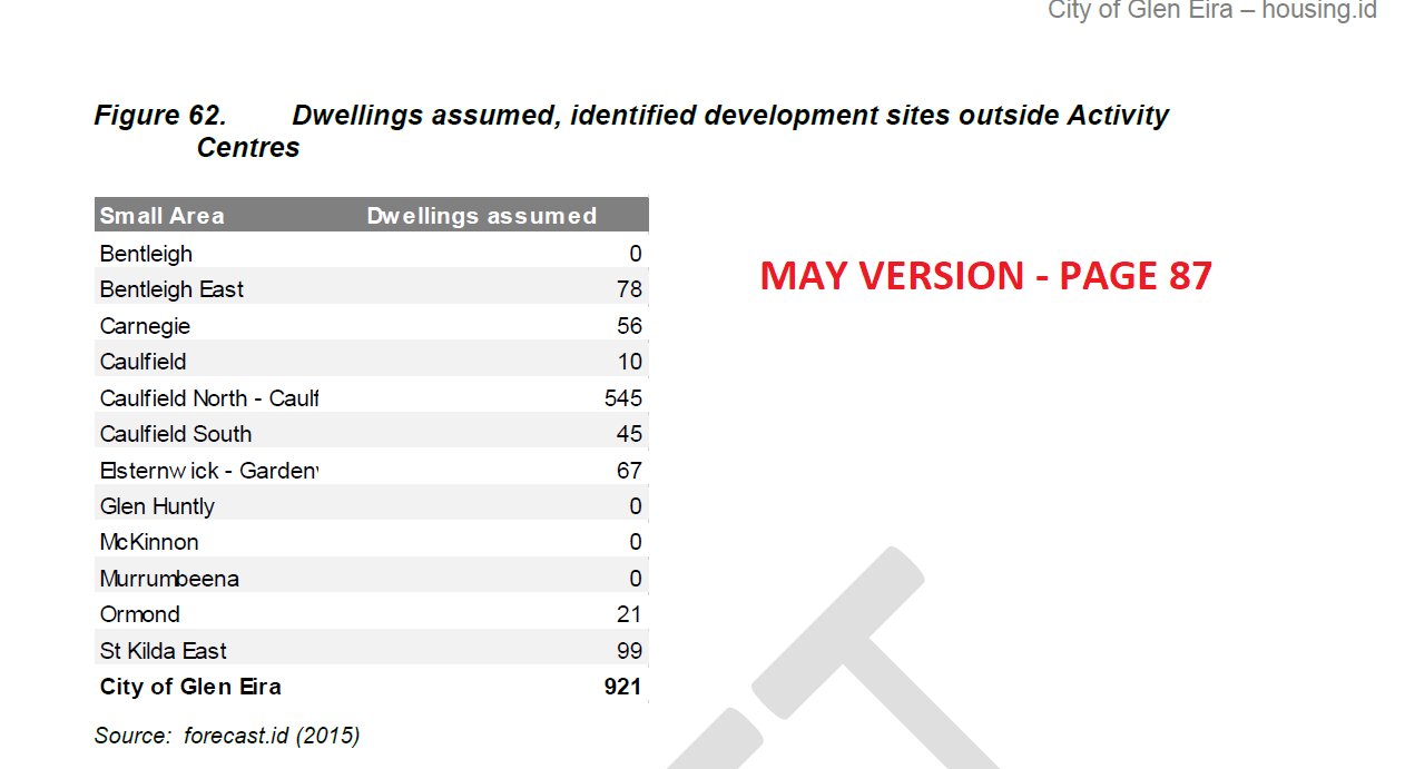
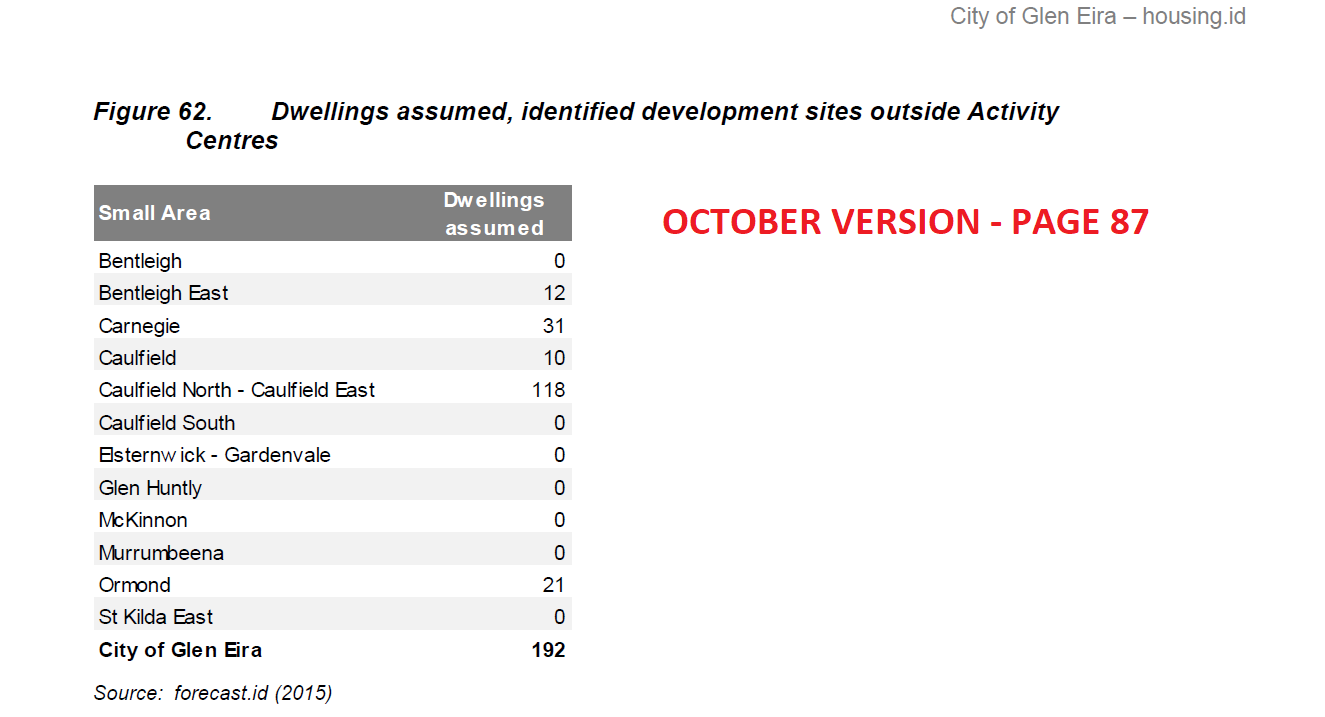
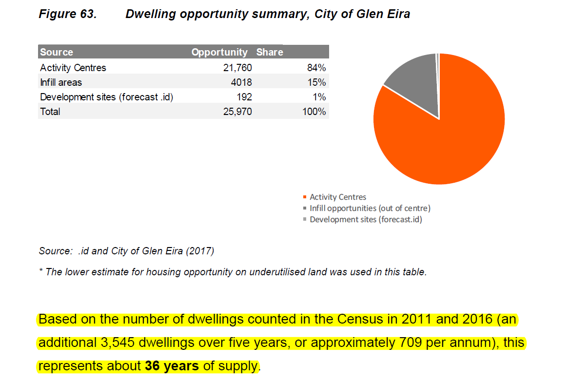
 We don’t believe that it is too much to ask that when documents are published years after the facts are known, that they be accurate, detailed, and actually informative!