GE Planning


We continue our ‘series’ which we started in February on councillor decision making on applications and the results at VCAT. Now that there is finally a planning scheme review being undertaken, council must address the core issues of what is missing in council’s planning scheme.

In our February post (https://gleneira.wordpress.com/2016/02/17/dumb-or-complicit-1/) we asserted that councillors have not learnt from their mistakes; that they have been content to play to the gallery and repeatedly knock off a level or two, or the number of apartments, and think they have done their job. History shows that in every single decision involving a reduction in height or dwellings and where the developer has subsequently gone to VCAT such councillor decisions have been well and truly trounced.

When decision after VCAT decision spells out in lurid technicolor what is amiss with the planning scheme and nothing has been done to address these gaping holes, then as we stated in our header – either councillors are incredibly dumb or completely complicit in a pro-development agenda!

With elections around the corner, readers need to take careful note of who voted for what!

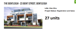
COUNCILLOR DECISION – #5 – 8 Railway Crescent, Bentleigh. Application was for 3 storeys and 10 apartments. Officer recommendation – permit granted. Esakoff and Lipshutz moved motion for 3 storeys and 8 units. Motion was carried unanimously. Developer went to VCAT and was awarded his 10 units. Member decision included: I could perhaps understand Council seeking to remove Dwellings 9 and 10 if there were direct and unacceptable amenity impacts, such as overshadowing of neighbouring properties, or if the site was on the boundary with land included in a Minimal Change Area and in the Neighbourhood Residential Zone.  But neither of those circumstances applies here. The land is well away from the boundary of a Minimal Change Area and the only adjoining property affected by overshadowing is to the east and any shadow is only cast in the mid afternoon to the non-secluded front yard. I note that Mr Wood, Mr O’Brien and Mr Filatov do not live adjacent to the site and are not directly affected by the two dwellings proposed to be deleted. Ms Snell agreed that the development complies with all the numeric ResCode standards

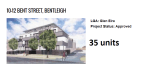
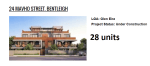
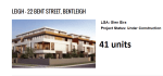
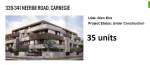
COUNCILLOR DECISION -#6 – 24-26 Mavho Street Bentleigh. Application was for 4 storeys and 28 dwellings. Officer recommendation to grant a permit. Hyams and Lobo moved motion to grant permit for 3 storey and 25 units. This motion was carried with Pilling voting against it. Developer went to VCAT and got his 4 storeys and 28 units! The decision reads in part – I am not persuaded by Council’s zoning submissions that the surrounding zoning will in some way perform the role of limiting development or height in this case on this site. This site is clearly in the Residential Growth Zone and does not share a boundary with any other zone….I am not persuaded that this site is to perform a transition role. The is a zone and an area of intensive development. Other sites further will peform this transition role. The fact that Council has rezoned 24 Mavho Street Residential Growth as is the adjoining lot at 22A and 22B Mavho Street and then the zone changes to a General Residential Zone at 20 Mavho Street, tells me that the transition site and role is performed at 20 Mavho Street.

In what can only be seen as a total admission of failure (and straight out incompetent planning) Hyams and Delahunty moved this Request for a Report at last Tuesday night’s council meeting –

Crs Hyams/Delahunty

That a report be prepared on whether Council should apply for a planning scheme amendment to raise the Public Open Space Contribution Levy above the current 5.7%.

Thus, just on one year since the amendment was gazetted, council is now acknowledging that 5.7% falls far short of what is required. The ‘excuses’ provided were that Council’s ‘assumptions’ and conditions have changed. Nothing could be further from the truth! The so called building boom owes much to the introduction of the new zones which date from August 2013 – 2 years before the open space amendment was gazetted and a year after the deficient open space strategy was made public. The writing was literally on the wall and council needed to introduce a far higher open space levy to ensure that funds were available – but more importantly that the amount of public open space per individual did not decline.

Nor does this sudden interest in open space account for 11 years of doing absolutely nothing to raise funds to purchase open space. The levy from 2004 to 20015 was not only miniscule, but a gift to developers. Exacerbating the situation was the failure of council to purchase additional space apart from 2 house blocks in Packer Park even though the lack of public open space in Glen Eira was known and stated in both the 1987 and 1998 open space strategies.

What is even more disgraceful is the repeated and continuing slurs (including last Tuesday night) cast on the 2 objectors to this open space amendment and the completely bogus claim that their objections cost council in the vicinity of $1 million. How much did council cost ratepayers from 2004 to 2015 with its laughable levy rate? And how dare the likes of Hyams and Lipshutz in particular cast slurs on residents who decided to exercise their legal rights and object to council’s inadequate proposals and shonky strategic planning?

It is now obvious that 2 residents were able to forecast  what would happen a lot better than ‘consultants’ who cost $130,000 and councillors who were determined not to listen and bureaucrats who were only intent on limiting the damage for developers.

FYI, here is part of one of the submissions presented to the Planning Panel that argues strongly that a 5.7% levy is inadequate – especially since Stonnington with the second least amount of public open space opted for an 8% levy. In the end Stonnington achieved its 8% levy for 4 major suburbs – South Yarra, Windsor, Prahran and Armadale. The total area of these 4 suburbs at 8% will alone bring in more than Glen Eira’s 5.7% across the entire municipality. Further, Stonnington’s objective is to keep creating further open space with its $36 million in the kitty as opposed to Glen Eira’s splurging on mega palaces and concrete and disowning its twice passed resolution that the levy would go for the purchase of open space and not the ‘maintenance’ of existing open space!

“NEED FOR AN INCREASED LEVY

Contention: The proposed contribution levy of 5.7% is inadequate to meet the open space needs of the existing and future populations of Glen Eira.

Throughout this submission I have pointed out that:

  • The projected population figures are extremely conservative
  • The cited potential land development area is well and truly underestimated
  • The rate of development in Glen Eira has risen astronomically
  • The stated land values are well below the current market figures
  • Infill development figures and how they impact on potential revenue is ignored
  • Impact of strategic development sites is ignored

As a consequence of all the above, a 5.7% levy, and the overall recommendation to create (at a maximum) another 11 or so hectares of public open space will not meet the needs of the community. I acknowledge fully that there is no standardised methodology for determining what an appropriate contribution levy could be. I also acknowledge that the consultants were to a great extent dependent on figures provided to them by council. It is precisely these figures which I believe are suspect and need to be fully reviewed and updated.

Without access to current council data I can only hypothesize on what would be an appropriate levy given all the above factors. What I do find telling however is the comparison with the current Stonnington proposed contributions levy and the analysis done by their consultants. As pointed out in an earlier table, Stonnington is two-thirds the size of Glen Eira, has a smaller population, and has the second lowest amount of public open space in the state, behind Glen Eira’s record of having the least amount of public open space. Yet Stonnington’s consultants find that:

Based on current provision of open space throughout the City, the Strategy identifies that acquisition of 53 hectares is required to meet the benchmark. When factoring in population growth acquisition of 108 hectares would be required to meet the benchmark[1]

The Glen Eira OSS provides no quantifiable benchmark to work towards. If no targets are set, then I’d argue that it is extremely difficult to calculate what revenue is required in order to meet the most minimalist standards of open space per individual – especially if the data is highly suspect. At a maximum, the OSS recommends the acquisition of another 11 hectares of open space in the entire municipality.  The  least recommended would only equal another 2.2 hectares, and the ‘average’ is given as 6.51 hectares. None of these possibilities are adequate. If Stonnington is currently finding a deficit of 53 hectares then Glen Eira’s claims to need only an additional 11 hectares at best, does indeed appear well below the mark.

There’s also Stonnington’s request that their contribution levy be raised to 8%. Why a council with the second least amount of public open space should ask for an 8% levy, and the council with the least amount of public open space only demands 5.7% levy is quite frankly, beyond me.

Nor do the consultant’s reports provide any historical breakdown of levy contributions per precinct as does Stonnington. All that is cited are the cumulative figures for each financial year. Without such a breakdown it is incredibly difficult to gauge where the majority of subdivisions are occurring; the nature, scope, and size of these subdivisions and how these may indicate what occurs in the future – especially in the urban growth centres.

Stonnington has also created a list of proposed projects for its entire 20 year plan and its figures are based on the anticipated costs. Apart from disclosing 3 projects in the current budget, Glen Eira has not revealed whether in fact it even has such a long term plan and what the specific projects might entail and hence their probable costs. Again, a highly dubious basis upon which to calculate what needs to be done over the next 13 years.”

AND THE CONCLUSION

“Based on all the above I would strongly urge the Panel to recommend a higher contributions levy than what is currently proposed. I am not able to provide a definite figure since I have no access to the current data and I do not consider it my task to do so. That belongs to council and the consultants.

If the residents of Glen Eira are to be well served via the acquisition of the necessary public open space, then I urge the panel to recommend a total review of what has been proposed and that this is based on the most up-to-date and accurate data. Glen Eira residents cannot afford to undergo any further loss of open space which is inevitable I believe, if the current proposed amendment remains unchanged.”

[1] SGA Economics & Planning. (2013). Assessment of Mandatory Open Space Contributions – Page 16

Here are some more developments taking place in our municipality. Whilst councillors have sat on their hands doing bugger all about an inept planning scheme and blaming VCAT for all their ills, developers have been having a field day. This is the inevitable result – 5 developments alone providing what the planning scheme says is the ‘average’ number of new dwellings per year! Please also note that some of these are not even in what is euphemistically called our ‘Urban Villages’ (Bentleigh, Elsternwick, Carnegie) but in the now defunct Neighbourhood Centres, which are supposed to have only ‘medium density development’.

If this is not the Glen Eira you want, then make your views heard at the current Planning Scheme Review. Insist on real change and a real commitment to protecting residential amenity. Do not be satisfied with a mere tinkering of the current scheme that in the end achieves very little.

We have already outlined what residents at the first forum thought should be done. We repeat some of these:

  • structure plans
  • parking precinct plans
  • developer levies on car parking waivers and on drainage
  • stringent review of the zones and the schedules
  • tree protection and greater emphasis on environmental sustainability
  • full and comprehensive heritage review

1

2

3

4

5

Why is it that Glen Eira is so out of kilter with every other council, especially when it comes to providing information to residents on vital issues, or even providing decent, informative answers to public questions.

On Tuesday night, several questions were asked in relation to meetings with the Minister (Jacinta Allen) on Skyrail. Here is one question and the response –

“Jacinta Allan met with the Kingston City Council on Thursday 21 April to discuss level crossing removals through their area. Has Ms Allan or the LXRA met with GlenEira Council to discuss crossing removals through Glen Eira, and if so what was the outcome of those discussions?

The Mayor read Council’s response. He said:

“At the invitation of the Minister for Public Transport the Mayor and the Chief Executive Officer met with her on 8 March 2016. Councillors and Council Officers have met with representatives of the LXRA on many occasions. Such meetings have involved the exchange of information and views. Council has, on each occasion, taken the opportunity to strongly advocate for community consultation on the grade separation projects.”

What is staggering about this reply is:

  • The failure to answer the most crucial part of the question (ie outcomes of discussion)
  • Why it should take a formal public question for council to even acknowledge that a meeting has taken place

Thankfully, not all councils are as secretive as Glen Eira. Kingston put out a Media Release within days of their meeting with the Minister. Here is what they had to say –

Kingston Council meets with Transport Minister to pass on community concerns

26 April 2016

Kingston Council met with Victorian Transport Minister Jacinta Allan last week to raise community concerns about the Level Crossing Removals project.

Minister Allan, Mordialloc MP Tim Richardson and LXRA representatives visited Council’s Cheltenham offices to hear directly from the Mayor and councillors and discuss upcoming community consultation on the project.

“The meeting was incredibly productive and we were able to pass on community concerns and advocate for a well-planned strategic approach that makes the most of this once-in-a-generation infrastructure project to deliver great long-lasting results for our community,” Mayor Tamsin Bearsley said.

The Minister confirmed in principle that the next stage of community consultation, due to take around the middle of this year, would include detailed information on different options available at each individual site including environmental impacts, engineering analysis, acoustic reports and estimated costs so our community can make an informed decision and have their opinion clearly heard and taken into account,” Cr Bearsley said.

The Minister’s visit followed recent calls from Kingston Council for improved community consultation by the Level Crossing Removal Authority before any decisions are made about level crossing removals in the area.

“We presented a short video from the Chelsea and Bonbeach Train Station Group to show positive approaches and ideas being generated by our community that are alternatives to a skyrail,” Cr Bearsley said.  

“Minister Allan had also been briefed by local MP Tim Richardson on the heritage issues surrounding the Mentone station and the unique sensitivities along the Frankston line due to the close proximity of Port Phillip Bay.”

Mayor Tamsin Bearsley said councillors had received strong community feedback opposing a skyrail option for the Frankston line and criticism of recent public consultation sessions held by the Level Crossing Removal Authority (LXRA).

“Kingston Council will continue to work closely with our community, the LXRA, local MPs and the Minister to ensure our community is kept well-informed and actively involved in this project.”

The Victorian Government’s list of 50 level crossings for removal includes seven in the City of Kingston – Centre Road Clayton on the Dandenong line and six level crossings on the Frankston line.

Source: http://www.kingston.vic.gov.au/About-Us/Media/Media-Releases/Transport-Minister-visit

Another public question asked on Tuesday night was this –

A group of around 20 residents met Jacinta Allan last Thursday 21/11/16 at 10.40
am outside Kingston City Council following a meeting regarding Skyrail for the
Frankston line. The Kingston city Council CEO John Nevins, Mayor Cr Tamsin
Bearsley, Mayor Cr John Ronke and MP Tim Richardson can also attest to
Jacinta’s promise to meet and finally meet and respond to unanswered
correspondence and questions with our community. She indicated she was happy
to meet and to organise a meeting through Tim Richardson (or presumably our local
member). Will the Gleneira Council please follow up on this invitation and cite this promise?

And Council’s woeful response?

“If, as you say, the Minister for Public Transport has said that she is happy to
organise a meeting through the Member for Mordialloc then it would be best for
you to contact either the Minister or the Member for Mordialloc directly. You may also wish to direct your request through either the Member for Bentleigh or the Member for Oakleigh who are other members of the Government with grade separations happening in their electorates.”

PS: it is also worth pointing out that the 100 or so public questions which were taken on notice from the previous council meeting are not included in the minutes – as required by the Local Law!!!!!

PS: here’s a photo we received in conjuction with a comment. It shows a trailer parked (in a No Standing Zone) as part of the LXRA operations and presumably without a permit. Yet, council in its responses to public questions claimed that only 5 permits had been granted for ground works. The trailer has been there for well over a week! Thus, how much faith, credibility, can residents place in any response they receive from council?

car

Council’s record with GESAC, Caulfield Park pavilion, and countless other major works has one thing in common – the doubling of costs! GESAC was supposed to be roughly around $28m. We estimate that it is in the realm of $50 to $60m. The same with other projects. Now we have the Booran Road Reservoir.

In 2008, the estimated cost was ‘over $5m’. (Minutes of 1st July, 2008). Admittedly costs have gone up over time and there are always unexpected expenses. However, should this mean a doubling of expenditure? What does this say about ‘business plans’ and sound management and oversight?

Given the way in which council provides data it is extremely difficult to come up with figures for how much this development is actually costing ratepayers. What we do know is what is contained in the minutes and to put it simply – these figures do not add up!

In 2011 the budget stated – Booran Road Reservoir – The SRP allows for the reinstatement and redevelopment of the Booran Road Reservoir Site – $4m in 2017-2018 and $3.5m in 2018-2019. (minutes of 27th April 2011) That’s $7.5 million.

In 2013 the figures became – reinstatement and redevelopment of the Booran Road Reservoir Site as Public Open space – $5m in 2015-2016 and $4.5m in 2016-2017 (minutes of June 25, 2013) – $9.5million

In 2015 this became – Booran Reserve – reinstatement and redevelopment of the former Glen Huntly Reservoir Site as Public Open Space $4.84m in 2015- 2016 and $3.93m in 2016-17 (includes State Government funding of $585k). (Minutes of 23rd June 2015)

In the meantime of course, there has been massive expenditure on a variety of tenders and other ‘expenses’. Here are some – all taken from the minutes.

  • Booran Road Reservoir site – allow $50k for site investigation works. (Minutes of 1st July 2008)
  • Booran Road Reservoir Consultation and Master Plan Development $60k AND Feasibility Study – Booran Reservoir – $15K (minutes of 28th June 2011)
  • BOORAN RESERVOIR SOIL CONTAMINATION $60,000 (minutes of 30th August 2011)
  • BOORAN ROAD RESERVOIR COMMUNITY CONSULTATION AND MASTER PLAN DEVELOPMENT – $200,000 (minutes of  2nd September 2014)

Tenders are also interesting – especially toilets:

  • Toilets – ($473,000.00 including GST (1st September 2015)
  • electricity station – $50,215 (Inc. GST) (MINUTES 21ST September 2015)
  • The result of this tender was not published in the minutes – Supply and Installation of two double Automated Toilets – $400,000  (MINUTES OF JUNE 30TH, 2015)
  • Demolition of Sections of Existing Concrete Walls, Floor Slabs, Earth Embankments andAssociated Works for an amount of $838,504.32 exclusive of GST ($922,354.75 including GST). (23rd September 2014)
  • More toilets – $359,693.40
  • Playgrounds – ($1,886,475.80 including GST) – 11th August 2015
  • The Water Play Feature – $1.9 m24th November 2015

But the best is what’s in the current agenda – an estimated $4.01 million for ‘lighting and landscape works’ with only 3 selection criteria!!!! Please note that other councils often have 6 or 7 selection criteria.

Adding up these figures, the grand total is well and truly above $9 million ($7m alone for 2015/6) and we expect plenty more to be spent.  Yes, there might be ‘carry forwards’ but this still does not equate with what the budget figures state. Thus, the question of ‘how much is this really costing’ is worth asking – especially in an era of supposed ‘cost cutting’ and ratecapping!

CLICK TO ENLARGE

PS: Here are some of the latest designs

ve

mckz

Tonight was the first of the 5 ‘community forums’ on the Planning Scheme review. About 30 residents showed up. Magee introduced the evening and then departed due to a prior engagement. He reiterated that Glen Eira has about 1300 people moving into the municipality each year and that they need to live somewhere. VCAT was still his main villain! His ten minute introduction was followed by another ten minute introduction by a ‘facilitator’ hired by council.

Residents were seated at tables with a council planner assigned to each table and a scribe given the task of recording people’s responses to the set questions from the discussion paper. At the conclusion of ten minutes for each theme, the elected scribe reported back to the entire gathering.

The following proposals were repeated several times and from most of the groups:

  • The need for structure planning
  • The need for tree protection
  • The need for parking precinct plans
  • The need for preferred character statements
  • The need to curb overdevelopment
  • The need for a full heritage review
  • The need for policies with more ‘bite’
  • The need for greater environmental considerations in terms of building design and vegetation
  • The need to protect local shopping strips
  • The need to review the zones and schedules
  • The need for height limits overall
  • The need for developers to pay for parking waivers and infrastructure

Sadly, the opportunity to ask questions and receive responses that the entire audience could hear, was not provided. It was clear that the focus was to be on the set questions from the discussion paper, rather than an open and free discussion. When one resident towards the end interrupted the facilitator as she was summing up and asked why no forum was scheduled for Bentleigh, the response was that council could not find a venue! We should also point out, that if council was really determined to engage with the community, then surely 6pm is not the ideal time! And finally, we ask, is it sheer coincidence that the forum scheduled for Carnegie, is to be held so late in the piece (25th May), with only 6 days left before submissions close?

PS: this is why the above recommendations are crucial

Untitled

Activity Centres & Structure Plans

State governments of all persuasions have encouraged and endorsed councils’ implementation of structure plans. Here’s why:

Structure plans provide the foundation for activity centres change by defining the preferred direction of future growth and articulating how this change will be managed.

Structure plans will guide the major changes to land use, built form and public spaces that together can achieve economic, social and environmental objectives for the centre. To encourage development within centres, government policy encourages local governments to review the purpose and function of individual centres and to revise local planning policies through a program of structure planning for each of their activity centres. (Source: http://www.dtpli.vic.gov.au/planning/urban-design-and-development/Activity-Centres/structureplanning)

Stonnington goes further –

A structure plan is a planning tool that sets out a vision for the future development of a place. It establishes a planning and management framework to guide development and land-use change and aims to achieve environmental, social and economic objectives.

A structure plan takes into account all of the issues affecting an area, including its buildings and spaces, land uses, activities and transport. An essential aspect of the structure planning process is feedback from the community on how the area should evolve. An important phase of the structure planning process requires consultation with the community, local residents, traders and the development industry to determine the best outcome for the centre. Each structure plan will require consultation. (Source: http://www.stonnington.vic.gov.au/Vision/Strategic-Planning/Structure-Plans-and-Urban-Frameworks/Structure-Plans-and-Urban-Design-Frameworks)

Glen Eira does not have structure plans whilst every other council in the metropolitan area does. Residents have never been provided with an adequate explanation as to why not. Yet we find this paragraph in the current discussion paper on Theme 2 – Urban Design in Activity Centres –

Guidance for development in these areas can include local policies, structure plans, urban design frameworks, zones, and overlay controls. Currently, Glen Eira utilises a combination of zoning and local policies to outline the preferred planning outcomes for its activity centres.High-rise development in commercial zones has recently been raised as a concern as prescriptive height limits do not apply at present.

Readers should also note that:

  • Urban design frameworks do not exist.
  • Design and Development overlays of note do not exist
  • The only ‘overlays’ in activity centres are student parking, and some for flooding and heritage. Yet, in their wisdom, council still decided that some heritage areas should be included in Residential Growth Zones (ie in Bentleigh).

As far as ‘preferred planning outcomes’ goes, all that the planning scheme contains for its major activity centres of Bentleigh, Elsternwick and Carnegie, are ill-defined, nebulous and contradictory statements. For example – readers should ask themselves what the following means, when no definitions, or precise criteria  are provided.

BENTLEIGH

  • Where opportunities exist, a range of housing types be promoted at increased densities.
  • Where opportunities exist, medium density housing be encouraged in the residential areas surrounding the centre.
  • The managed change of the neighbourhood character of these areas be encouraged.

CARNEGIE

  • Encourage higher-density residential development.
  • Increased density residential developments be encouraged.
  • The managed change of the neighbourhood character be encouraged.

ELSTERNWICK

  • A multi-storey car park may be developed within the existing Coles supermarket car parking area if sympathetically designed to complement the surrounding built form.
  • All developments provide adequate off street parking to protect the amenity of the residents.
  • New developments provide an appropriate interface to adjacent valued community assets such as the churches
  • This precinct be encouraged as an area for higher density development at heights compatible with adjacent buildings.

The height of residential developments be determined by:

  •  Site context, including the scale and character of surrounding development.
  • Site characteristics, including area, dimensions, orientation and topography.
  • Existing development on the site, including height, bulk and site coverage.

Returning to the discussion paper, we find the most extraordinary sentence:

This (structure plans) can offer certainty for residents and developers alike but takes time to implement due to the complexity of research required.

Should we interpret this as an admission that because something is ‘complex’ that it is beyond the capability of council administration?  And if it does ‘take time’, then council has had 17 years to get its act together and produce some decent planning.

Here are some questions that residents should consider asking their representatives:

  • Is council contemplating introducing height limits on commercial areas only in the major activity centres of Bentleigh, Elsternwick, and Carnegie? Will council introduce height limits on commercial sites in its Neighbourhood Centres such as Bentleigh East, McKinnon, Ormond, Murrumbeena, Caulfield North, Glen Huntly, etc?
  • Why has council refused to introduce structure planning and will they begin this process now?
  • Why are heritage areas zoned as Residential Growth zones in Bentleigh, when the government’s practice notes clearly state that such areas should be excluded from the RGZ?

PREFERRED CHARACTER STATEMENTS

Part of any planning scheme review is the imperative to locate any gaps or deficiencies in the scheme and to plug such holes. Councils generally approach this task by diligently analysing VCAT decisions and determining the grounds that VCAT stated in rejecting council positions. The next step is to return to the planning scheme and determine how it can be bolstered to ensure that the grounds available to VCAT are closed off or at the very least, made far more difficult to ignore.

Needless to say, there is nothing in the current Discussion Paper which provides even a hint as to what the ‘problems’ might be. Yet, decision after decision makes it absolutely clear – the failure of council to provide any statement as to ‘preferred neighbourhood character’ in housing diversity (ie GRZ, RGZ) and totally inadequate ‘policy’ in minimal change (NRZ) areas – where ‘waffle’ replaces fine grained statements.

Yes, we repeat! Even large areas within the Neighbourhood Residential Zones are in the same boat as residents living in GRZ or RGZ zones.

Here are two recent VCAT decisions for developments in the so called ‘protected’ areas of Neighbourhood Residential Zones. Some areas have council’s version of ‘preferred character statements’ which amount to nothing more than waffly, motherhood pronouncements, whilst other areas in the NRZ do NOT HAVE even this pretence of such a statement.

The Council’s concern also relies on a misplaced emphasis on preferred character rather than existing (or prevailing) character. It is correct that the minimal change area policy has a specific objective relating to preferred character. However, there is no formal statement of preferred character in or under the scheme for the relevant character precinct in which the land is located. The objective relating to preferred character is to ‘encourage development that is responsive to its site and context, integrates with and enhances the prevailing neighbourhood character. (http://www.austlii.edu.au/au/cases/vic/VCAT/2016/306.html

The Glen Eira Planning Scheme does not include a preferred neighbourhood character statement for this area, and the Clause 22.08 local policy broadly encourages dual occupancy developments in this location in a side-by-side layout, provided that they respect the existing neighbourhood character of the area.

http://www.austlii.edu.au/au/cases/vic/VCAT/2015/870.html

Thus, further question that residents should consider asking their elected representatives are:

·       What gaps in the Planning Scheme has VCAT identified through its decisions? Will council address each and every one of these gaps?

·       Will council introduce preferred character statements for all of Glen Eira that are detailed, specific, and work to ensure that neighbourhood character is protected? If not, why not?

« Previous PageNext Page »