January 2018
Monthly Archive
January 29, 2018
The following screen dumps and quotes all come from council’s consultant’s report – Glen Eira Transport Analysis & Forecasting. (Uploaded HERE).
The examples we’ve chosen whilst concentrating on Bentleigh apply to all centres and make it absolutely clear that:
- Council intends to flog off public land for multi-storey parking lots
- Traffic management/parking plans will see a reduction in the current regulations for both commercial and residential development in our activity centres (more on this below)
- The agenda has always been, and remains more and more development and less and less car parking and decent development levies.
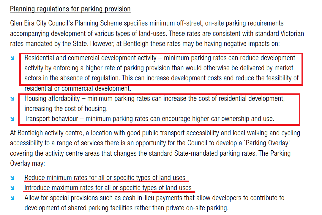
Currently the State Government ‘standards’ are clear (ie 1 car space for single bedroom, 2 car spaces for 3 and more bedrooms, plus rates for commercial enterprises depending on their nature and floor size). Council has the right to introduce what is known as parking overlays and thus change these requirements. Currently Glen Eira’s handful of parking overlays only concern student accommodation. We do not have any that control the commercial areas, or our activity centres. Council is now set to introduce such overlays.
We certainly have no objections to fostering greater ‘walkability’ or increased use of public transport. Our concerns relate to what is currently proposed and the spurious arguments that accompany these proposals. The central issues are:
- Parking overlays that include MAXIMUM rates instead of the current MINIMUM rates. If a maximum rate is imposed that means that developments can supply anything up to the maximum – ie a lot less! By contrast a minimum rate sets out the standard that must be met!
- Introducing a levy on developers for car parking waivers is fine in theory. It is not ‘fine’ however when the recommendation is a ‘reduced’ waiver so as not to deter development!
When for year after year residents have complained about the lack of adequate parking provision for residential and commercial with shop-top housing, then the intention to further reduce the meagre current demands is totally unacceptable.
We urge readers to carefully consider the following and what they could mean for Glen Eira!


Here are some quotes from this ‘discussion paper’. Again, please carefully note the implications and how some of these comments even contradict what is in council’s ‘Parking Analysis’ paper for Bentleigh, Carnegie & Elsternwick!
While this analysis suggests parking is sufficiently or perhaps slightly undersupplied in Bentleigh, consideration of some additional best practice benchmarks for parking supply is instructive, and highlights the extent to which parking may in fact be oversupplied in Bentleigh (page 18)
the Bentleigh activity centre has a significant oversupply of car parking, relative to best practice guidance on appropriate parking supply for centres well-served by public transport (page 19)
The expanse of parking to the north of Centre Road, however, has a much greater negative impact on the public realm, as shown in Figure 4-8. The space allocated to parking is disproportionate to the size of the public space available on Centre Road, and significantly reduces the potential residential catchment within a walkable distance to local retail, restaurants and public transport. Additionally, the large carpark dominated environs lack quality shaded footpath links, ‘eyes on the street’ and visual variation, further reducing the safety and appeal of active travel (page 25)
Cl. 52.06 rates are designed to provide parking supply that matches demand, essentially ensuring parking does not become a scarce resource. This however removes a potential signal to encourage people to alter parking behaviour and travel choices. The unintended consequence of this is that the extent of parking supplied in adherence to minimum parking rates significantly detracts from the vibrancy and quality of the public realm, and excessive space allocated to parking can crowd out the potential for greater active travel participation. (page 28)
As intensification and redevelopment of the activity centre occurs, there is likely to be some demand for car-free housing options. Planning policy that does not cater to this demand will impose unnecessary costs on housing provision and may encourage higher car ownership and usage (Page 29)
The substantial drop in population density with a 5-minute walkable catchment in comparison to a 10-minute catchment is also of concern, and suggests some additional main street shop top housing options would be welcome, as well as some infill development of existing surface car parking sites. (page 31)
Ahead of development of multi-story parking buildings or other replacement uses, Council should improve its understanding of the current use of existing parking facilities. Replacement of parking spaces on a like-for-like basis may not be required, depending on occupancy of current facilities and the future use of management tools such as pricing that may reduce parking demands. Benchmarking of parking supply at Bentleigh against best-practice guidelines (see Section 4.3.1) suggests parking supply may be significantly higher than levels that are appropriate in locations such as Bentleigh with high levels of public transport accessibility. Review of occupancy data further suggests that like-for-like replacement of parking spaces would be unnecessary and probably inappropriate (page 45)
January 23, 2018
There are many questions/issues regarding the so called structure planning for Virginia Estate that residents have been left in the dark about. Unfortunately, the 9 documents released by the VPA provide few answers. It should also be noted that three of the most important documents only made their appearance following the closure of ‘community consultation’!!!!!
What we still don’t know and what will have a major influence on the final development plans are:
- Will the entire 24 hectare site be rezoned to Commercial 1 or a Combination of Commercial 1 and Mixed Use. If this occurs then the entire site will be available for residential development. Or will we have a rezoning that makes this site a Priority Development Zone akin to Caulfield Village and thus opens up a completely different kettle of fish?
- If there is to be ‘office’ accommodation (ie a zoning of Commercial 2) then how much of the land will carry this zoning and therefore prohibit residential development?
- Will we have MANDATORY HEIGHT LIMITS or discretionary height limits?
- Will we have height according to Australian Height Datum (AHD) as with the Caulfield Village instead of a fixed number of mandatory storeys?
- Will the existing Schedule which states that any development plan SHOULD be exhibited be replaced with MUST BE EXHIBITED? If this isn’t changed then residents need to be aware that legally this means there are no objection rights once the plans come in and council doesn’t even have to exhibit the plans!
- Thus far nothing has been released about traffic, drainage, and levies payable by the developers. Reading between the lines it appears that council will be quite prepared to accept a meagre acre and a half for open space instead of exacting either a decent allocation of open space or some major financial payment. As for traffic and drainage, all we get are admissions that these present some major problems and will be attended to further down the track!
- We also are very sceptical regarding the stated number of ‘preliminary dwellings’ – 3000. When the site was 12.5 hectares Gillon proposed over 4000 dwellings (see below). Now that the site has literally doubled in size and there are two new ‘partners’, we are told that with a doubling of land size available the owners have magnanimously decided to only erect 3000 dwellings! The ‘escape clause’ is of course the word ‘preliminary’!!!!!! Beware we say!

What is even more disturbing about some of the documentation provided is to be found in the following:
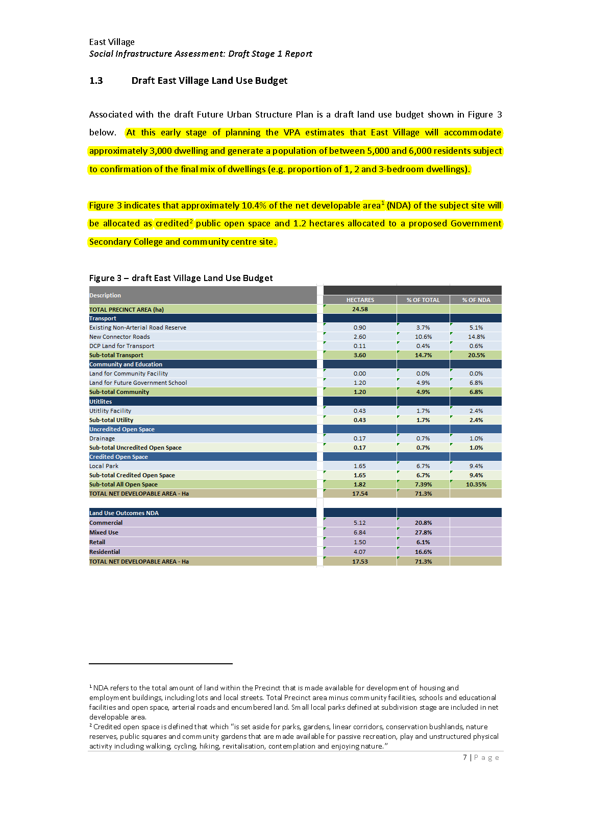
 As far as we know, the criterion of ‘net developable land’ is used only as part of calculations for open space levies/developer contributions – and not for ‘structure planning’ per se. Its inclusion here raises countless questions.
Further, if we look at ‘land use outcomes’ then a mere 4.7% as ‘residential’ is really pushing the limits of credibility. As it stands all of these categories (ie Commercial, Mixed Use and Retail) can allow residential development. A lot more clarity, precision, and less sleight of hand by the VPA, council and the developers would be highly welcomed!
January 19, 2018
January 16, 2018
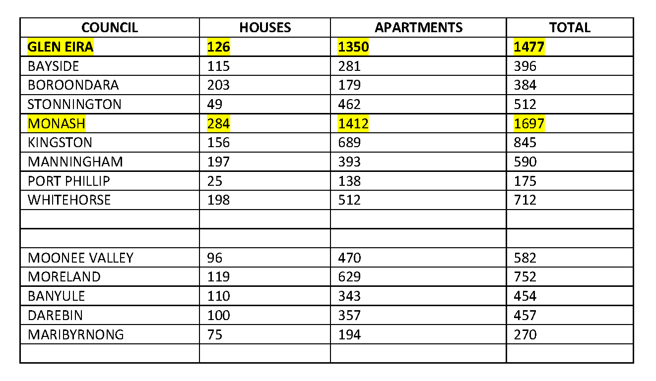
The Australian Bureau of Statistics (ABS) has released its latest figures for building approvals in local councils. The numbers are for a six month period – July 2017 to December 2017. As can be seen from the table below, only Monash has had a greater number of permits granted. However, once we take into account Monash’s size (81 square km) and its proportion of houses to apartments, then Glen Eira still leads the pack in terms of increasing density, lack of open space, minimal single house replacements, and most mind boggling is how our ‘neighbours’ can have less than half of the developments that are occurring in this municipality.
Given these figures it is unbelievable that our council is paving the way for more and more development via its current planning strategies rather than attempting to seriously curb this growth.
 PS – WE’VE UPLOADED THE ABS DATA HERE
January 14, 2018
Listed below is a sample of applications that have recently come into council. All are still awaiting decision. We have not included applications which are seeking amended permits for higher or more apartments, or any where decisions have already been made. Nor have we included the multitude of applications for two double storeys.
These few examples total well over 300 potential new apartments. Given council’s record at VCAT, and its pro-development agenda, we assume that the vast majority will be granted permits.
What these numbers call into question is the validity of council’s proposed structure planning and its claims about projected housing requirements that are supposed to justify the expansion of our activity centres and the rezoning of countless sites. Housing id forecasts tell us that McKinnon for example, is supposed to ‘average’ only a handful of new dwellings (18-27) per year over the next 20 years. In just a few months, McKinnon according to these applications is already up to 60 multiple dwellings. If the stats are so wrong, then it follows, that the planning is also way out of touch with what is occurring. What makes the situation even worse is that our neighbourhood centres, such as McKinnon, are still years away from having any structure planning completed!
Here’s the list –
15 Dudley Street, Caulfield East (nrz) – 8 STOREY, 106 STUDENT DWELLINGS – AREA 474 SQUARE METRES
43-45 Kokaribb Road CARNEGIE – 3 storey, 15 dwellings
32 Kokaribb Road & 259-261 Neerim Road CARNEGIE – 4 storey, 45 dwellings
331-333 Neerim Road CARNEGIE – 4 storey, 26 dwellings
82 Truganini Road CARNEGIE – 6 dwellings
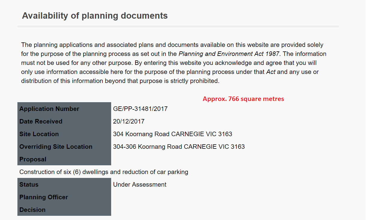
304-306 Koornang Road CARNEGIE – 6 dwellings
11 Beena Avenue CARNEGIE – 3 dwellings
7-11 Belsize Avenue CARNEGIE – 4 storey, unknown no. of dwellings
4 Lake Street CARNEGIE – 3 storey, 8 units
38 Toolambool Road CARNEGIE – 4 x 3 storey
13-15 Hamilton Street BENTLEIGH – 4 storey, 27 dwellings
17 Gilmour Road BENTLEIGH – 4 dwellings
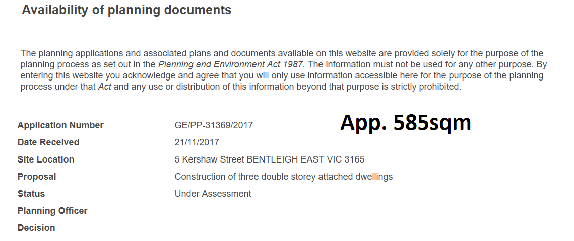
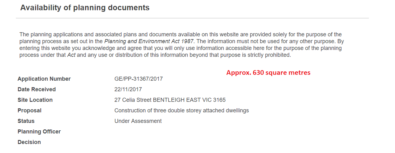
1 Heather Street BENTLEIGH EAST – 6 dwellings
45-47 Kangaroo Road & 33 Howe Street MURRUMBEENA – 15 dwellings
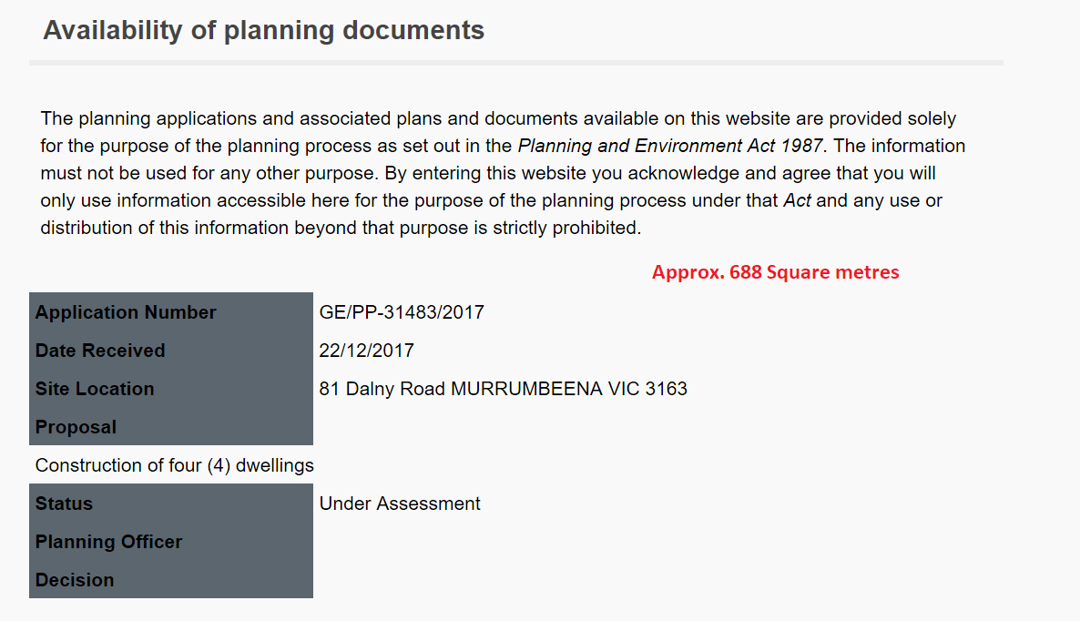
81 Dalny Road MURRUMBEENA – 4 dwellings
18 Railway Parade MURRUMBEENA – 3 storey, 17 dwellings
11 Perth Street MURRUMBEENA – 5 dwellings
8 Elm Grove MCKINNON – 3 storey, 6 dwellings
23 – 27 Prince Edwards Avenue MCKINNON – 18 x three storeys
12 Glen Orme Avenue MCKINNON – 3 x three storeys
16 Glen Orme Avenue – 3 dwellings
15-17 Station Avenue MCKINNON – 3 storey, 16 dwellings
27 Station Avenue MCKINNON – 4 x three storeys
40 Station Avenue MCKINNON – 3 dwellings
39 Lees Street MCKINNON – 4 dwellings
27 Draper Street MCKINNON – 3 dwellings
238 Booran Road ORMOND – 3 dwellings
3 Waratah Avenue GLEN HUNTLY – 8 dwellings
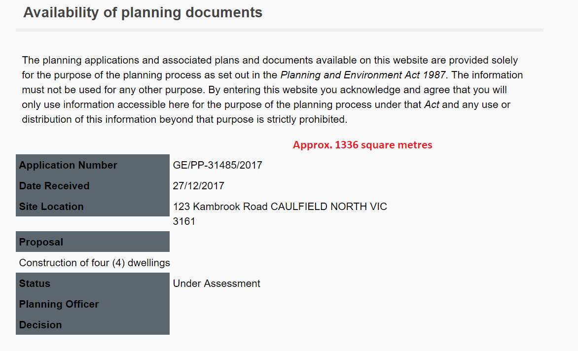
123 Kambrook Road CAULFIELD NORTH – 4 dwellings
204-206 Balaclava Road CAULFIELD NORTH – 5 storey meditation centre
1042 Glen Huntly Road CAULFIELD SOUTH – 3 storey, 9 dwellings
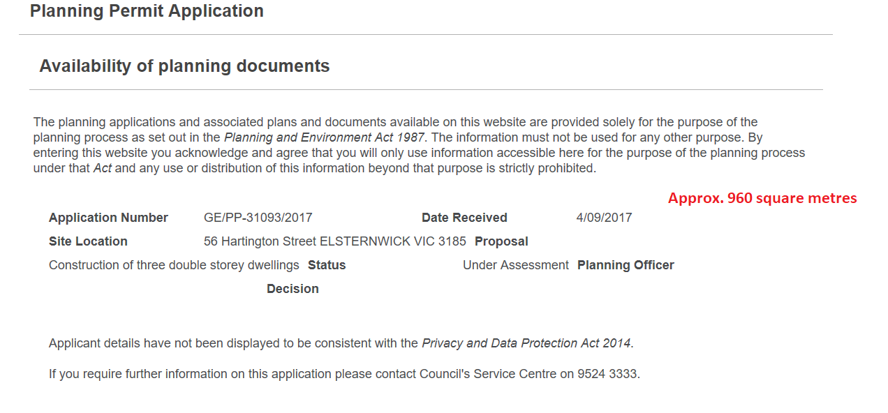
56 Hartington Street ELSTERNWICK – 3 dwellings
1 Riddell Parade ELSTERNWICK – 3 dwellings
January 9, 2018
Why is it that Port Phillip, Bayside and Kingston councils can publish the progress on the Elster Creek Catchment flooding mitigation project and Glen Eira is silent – apart from seeking councillor endorsement for the signing of the Memorandum of Understanding in June 2017?
These other councils have had no qualms in letting their residents know that:
- A community forum was held
- An action plan has been devised
- CEOs have met several times
In Glen Eira all of this remains secret. Since Glen Eira is the major ‘culprit’ as the Elster Creek Catchment covers huge areas of the municipality, one would have thought that Glen Eira residents should at the very least be kept up to date with what is happening. Yet, there was nothing up on council’s website regarding the recent community forum. There is nothing in the minutes regarding the proposed ‘action plan’. Why the silence and why when we have again had more recent flooding is there this reluctance to give this issue the attention it deserves?
Here is the link to the Port Phillip data – http://portphillip.vic.gov.au/E135525_17__Action_Plan_Elster_Creek_Catchment_-_FINAL_Oct_2017.pdf
And uploaded HERE is the report on the community forum.
January 2, 2018
The rush of multiple dwellings in the Neighbourhood Residential Zones (NRZ) continues unabated with more and more applications coming in. We feature the latest below.
Readers should remember the following:
- Council’s housing report fails to take full account of this rush given that the ‘estimates’ are for an additional 0.6 dwellings on lots over 700 square metres in size. The reality is that sites well and truly below 700 square metres are averaging an additional 1 to 2 dwellings per site.
- Since the introduction of Wynne’s VC110, councils have been given the right to include mandatory lot subdivision sizes in their schedules. Not a word has come out about this provision from council!
Assuming that the applications below will gain their permits, that means a NET GAIN of 9 dwellings in just these few sites. What this does to council’s overall ‘calculations’ and structure planning has not been realistically addressed. If the NRZ is now a defacto General Residential Zone and more and more development is occurring in the NRZ, then the crucial question is – why do we need to expand the activity centre borders? why do we need to ‘upgrade’ so many properties for higher density? why do we need 12 storey residential towers throughout the city? and why oh why is council so hell bent on facilitating more and more development?