GE Open Space


In several recent posts we have featured the data on the number of building permits granted to Glen Eira and its neighbouring councils. Planning permits are another indicator of development. The figures below are for the 2016/17 financial year and represent NET NEW DWELLINGS and not simply a one for one replacement. It is also safe to assume that since these figures are for the last year that many would not as yet have been started and definitely not been granted their building permits.

Given that Glen Eira is part of the Inner South East group (ie Boroondara, Bayside and Stonnington) these figures again reinforce the simple fact that our council is well and truly outstripping our neighbours in terms of current and proposed development.

Here are the stats:

Glen Eira – 1806

Boroondara – 1077

Bayside – 490

Stonnington figures aren’t available for the 3rd quarter. The other quarters show – 427, 98 and 141!

Source: https://www.planning.vic.gov.au/publications/planning-permit-activity-in-victoria

Ever since the introduction of the zones in 2013, Council has used VCAT as a convenient scapegoat. VCAT’s granting of permits of course has had nothing whatsoever to do with the inadequate planning scheme and the fact that developers could drive a truck through it! Time and again the blame was laid at VCAT’s feet but with no attempt to address the shortcomings of the planning scheme itself. We maintain that without Wynne’s order to get their house in order, Glen Eira would still be doing nothing since a further application for a review extension was undoubtedly the catalyst for Wynne to say ‘enough is enough’!

Now we have another scapegoat. This time it’s the State Government and the refrain of ‘we can’t stop development’. No one is arguing that development should be stopped. It is where and how much development is encouraged that is the sticking point. Plus of course the essential questions of capacity, density, and whether or not Glen Eira is meeting its housing needs for the projected population growth. These are the issues that council has been totally silent on.  Whether or not we have 37 years land supply, or the original Newton/Hyams claim of 90 plus years is beside the point. What needs quantifying and elaborating is whether or not Glen Eira’s rate of housing development is sufficient to meet its projected population growth and therefore there is no need to rezone areas for even greater development.

Judging by the various community forums on the current structure planning, what concerns residents is the extent of the development and what measures council is proposing that will ensure residential amenity and the environment is safeguarded. Allowing buildings of 8 to 12 storeys is not the majority’s view of reasonable development and neither is flogging off public land to facilitate such development.

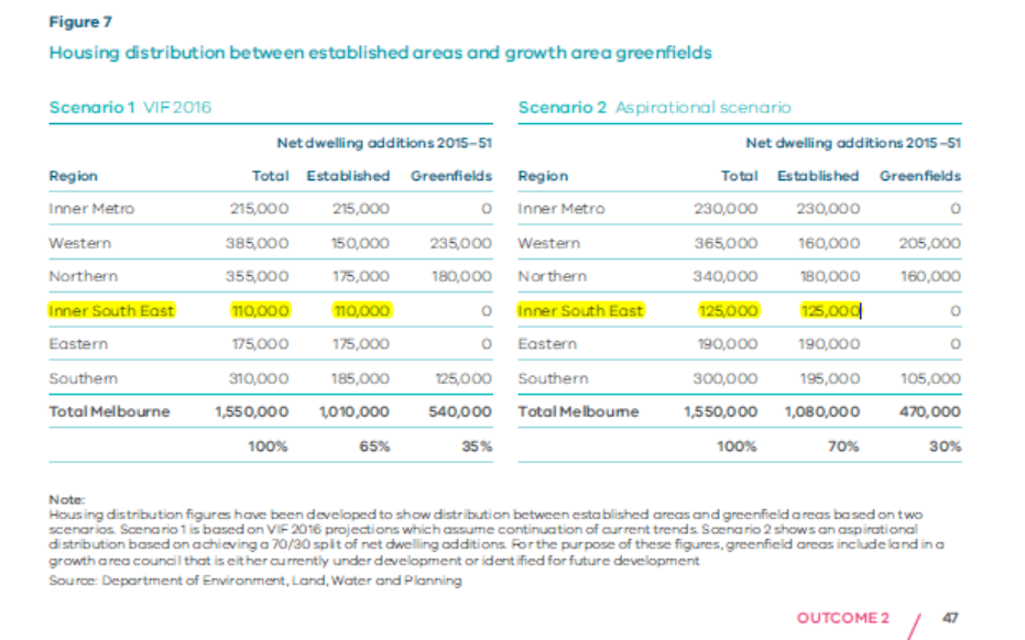
According to Plan Melbourne Refresh (2017-2050) Glen Eira is now part of the Inner South East group of councils which includes Stonnington, Bayside, and Boroondara. Here is what is forecast in two scenarios – (1) current projections and (2) ‘aspirational’ projections. According to this, 4 municipalities should be able to provide an additional 110,000 or 125,000 net new dwellings over the next 34 years.

Since these figures are for all South East councils, we would expect Glen Eira’s share to be roughly 27,500 or 31,250 net new dwellings by 2051. That’s another 34 years away and provides an average of either 808 net new dwellings per year or, for the ‘aspirational’ scenario, 919 net new dwellings per annum. The fact that since the introduction of the zones Glen Eira has more than doubled this ‘requirement’ per year has not been acknowledged. If development continues at this rate then Glen Eira will have reached its supposed ‘target’ not in 2051 but closer to 2025. And since structure planning is never intended to be anything more than a ‘vision’ for the next 15 years, this makes council’s planning even more suspect given its rezoning proposals.

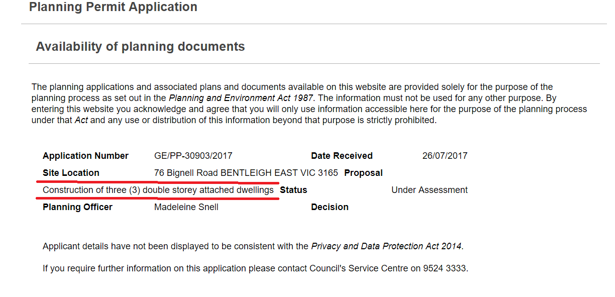
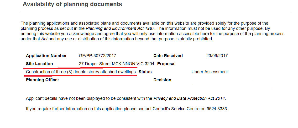
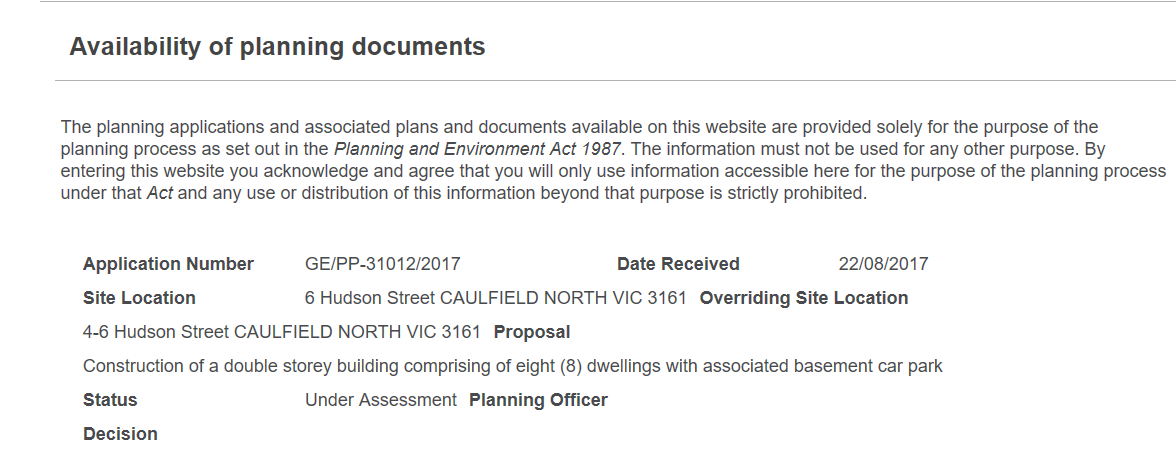
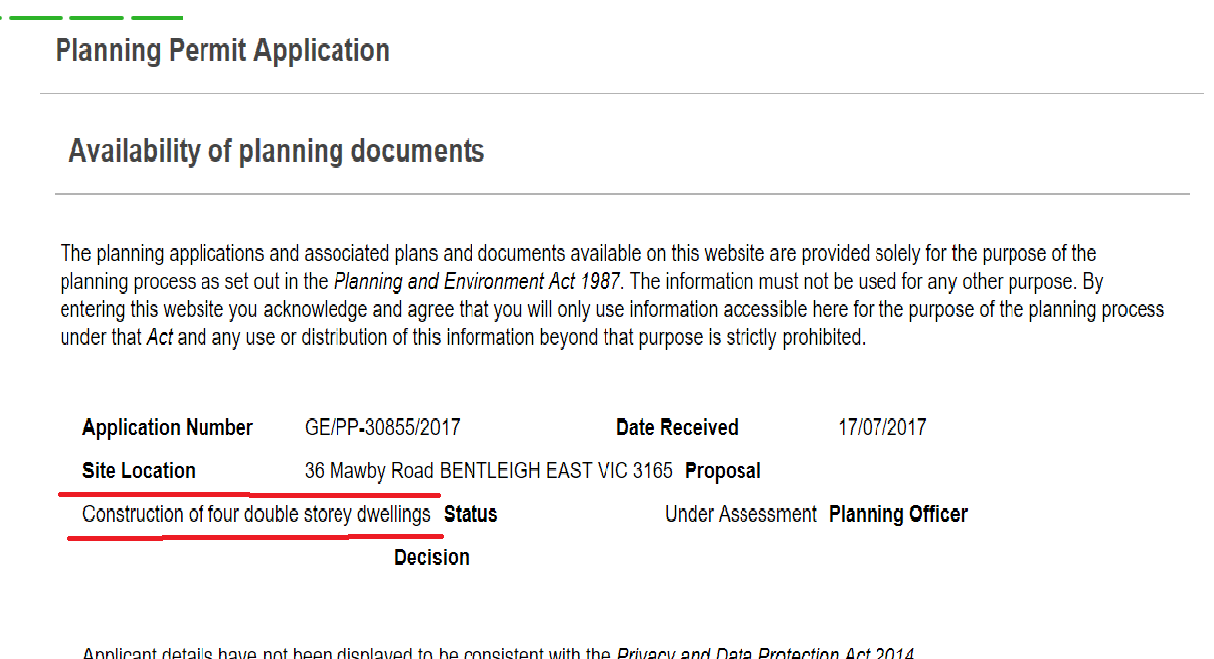
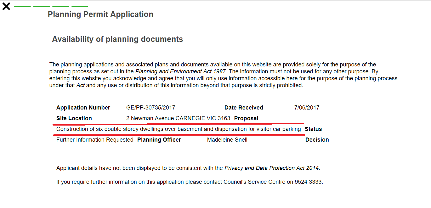
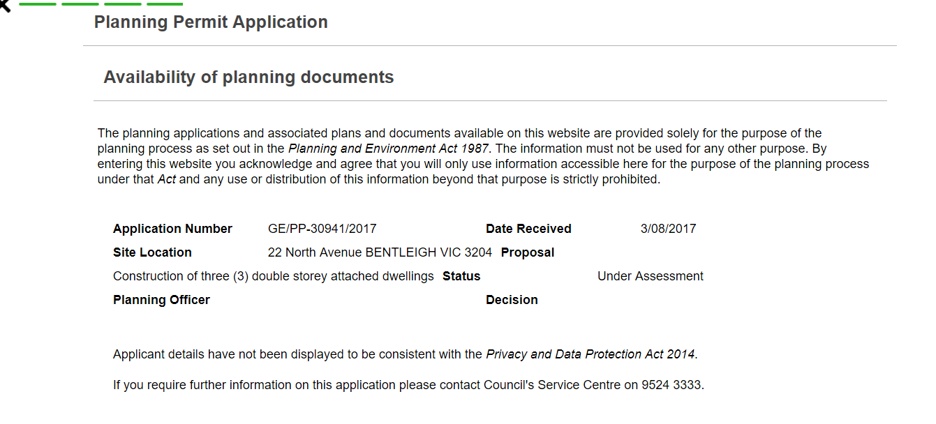
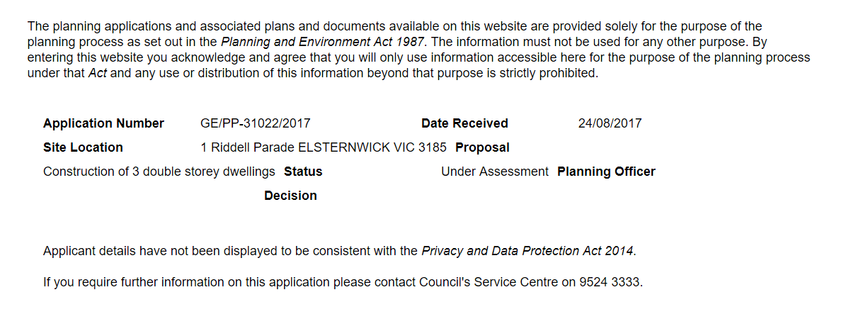
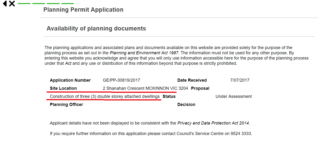
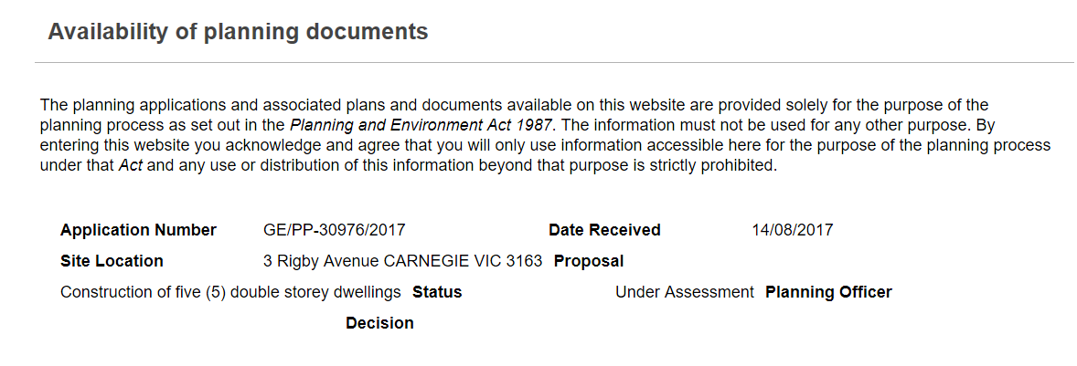
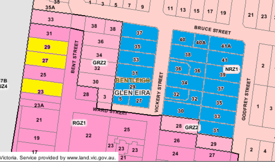
Another issue which council has remained entirely silent about and which is already having impact on dwelling numbers is Wynne’s introduction of VC110 and the removal of the mandatory 2 dwellings per lot in the Neighbourhood Residential Zones. Currently there are 9 applications in for multi-unit developments in these areas. Thus instead of 18 dwellings, we now have the potential for 38 dwellings on these 9 blocks of land. (see below).  Has council factored this into its planning? Why the silence? And what other countless loopholes can developers exploit before council actually introduces amendments that ensure the protection of residential amenity? Please remember that the new ‘garden’ area does not apply to land under 400 square metres. There is literally nothing to stop a developer subdividing his/her land first, and then applying for a planning permit. Result? No need for ‘garden area’!!!!

Until all of these aspects are taken into account, and until council provides concrete and reliable data to justify its expansionist planning proposals, residents have every right to believe that council’s agenda is to continue to facilitate more and more development – regardless of whether it is needed, much less sustainable! And finally, please bear in mind that Glen Eira already has up to anothyer 5000 dwellings waiting in the wings via the Caulfield Village development and the massive Virginia Estate! These latter developments barely rate a mention in council’s pronouncements!

Here is council’s version of the relevant stats for Carnegie and the proposed structure plan – According to the above figure the residents of Carnegie are supposed to be better off in terms of the number of properties rezoned to a lower height. As with the Bentleigh figures, the reality is far different. One example is the rezoning of Elliott Avenue and Tranmere where seven properties on the east side of Elliott Avenue will go from 4 to 3 storeys, and both sides of Tranmere will also be reduced by one storey. Nominally, that should make it 21 properties that will have a reduction in height. Sadly, it is far too late for 14 of these properties which are already set for 4 storey development. (Please note – we are counting the consolidated lots as 2 properties).

This image tells the full story – post zones.

  • No 1 Tranmere has been to VCAT. Given developers’ past history, there is always the second bite at the cherry by simply reducing the number of proposed dwellings by a handful. It will be back again.
  • Nos. 3 -7 Tranmere are currently up for sale and will have their applications in well and truly before any amendments see the light of day from council! (See: – http://raywhitecarnegie.com.au/properties/residential-for-sale/vic/carnegie-3163/house/1709969 )
  • No.8 Tranmere sold in April 2016, No.6 Tranmere in 2015 & No. 11 Tranmere sold in November 2016. Whilst these properties could possibly remain as ‘owner-occupier’ we don’t like their chances of remaining so given what is happening around them and the potential to make some major profit.

Thus Tranmere & Elliott are GONE, GONE, GONE thanks to what happened in 2013 and no revamping of the zoning at this late point in time is going to alter this fact.

So that readers fully understand the above image here is the legend –

  • Yellow infill means that permits have been granted for 4 storey developments, or will soon have applications coming in for 4 storeys.
  • The dark blue in Jersey Parade is another application currently in for 4 storeys
  • The light green represents other applications and/or permits
  • The red indicates the upgrade from 4 storeys to a potential 12 storeys.

QUESTIONS

  • Given examples like this, how much faith should residents place in council’s figures?
  • What effect will rezoning have if nothing changes in the schedules to the zones and when will council get around to actually doing anything with the schedules?
  • The destruction of these streets has been known for years yet council has tried time after time to avoid undertaking a planning scheme review. This has only happened due to Wynne’s refusal to grant another extension and the order to undertake structure planning.
  • What is the strategic justification for any of these changes? Does it make sense to impose a 12 storey height limit on residents zoned for 4 storeys? We keep hearing the nonsense about ‘right buildings in the right place’ and maintaining a ‘balance’. The only ‘balance’ we can find is an open invitation for more development and the selling off of council land!

PS: we’ve received an email from a resident telling us that nos. 7-11 Belsize Avenue has been sold to a group of developers. Anyone want to take bets on what will happen to this land?

We’ve received the results of a survey conducted by a resident. The findings provide plenty of food for thought that council needs to incorporate into its planning and thinking.

Our thanks to the resident for his time and effort.

Results are uploaded HERE

How much more public money is about to go down the drain because council refuses to accept the outcome of its first round of ‘consultation’ on the proposed redevelopment of Harleston Park? A million dollars was the original planned expenditure for this single park. We are now about to enter another phase of ‘consultation’ if the recommendations are voted through next Tuesday night.

We estimate that close to 90% of resident feedback was against the creation of a basketball area in the park. The vast majority of comments wanted to maintain the park’s passive atmosphere. So what does council do? Does it listen? It recommends a smaller ‘three point’ basketball court in a different spot. No dimensions are given and no comment is made on resident objections to the lurid blue originally suggested. Nor is there any evidence provided that a smaller court will create less noise or less conflict with passive areas.

This entire project raises innumerable  issues:

  • Why does every single park need to be a duplicate of each other – ie. some comments compared the proposals to what has been created in Booran Reserve. We also note that the Australian Standards do endorse that parks should differ and suit the local community. Glen Eira’s ‘interpretation’ of this comes via this paragraph – Public open spaces are a shared community asset. Living in proximity to parks does not afford residents greater rights over the use and development of these spaces than the wider community.
  • Why does council insist on spending a fortune on concrete plinths, so that again and again there is this ‘standardised’ look for all our open spaces?
  • Why can’t council publish concept plans that are legible and clear – which they certainly aren’t in the agenda papers?

We also challenge many of the comments included in the officer report. For example: Crime Prevention Through Environmental Design (CPTED) principles do not suggest lighting necessarily improves safety, and in some cases it may attract people to use the park later in the evening and night. This is not an intended outcome of the project and as such lighting has not been included – consistent with the status quo. 

If this is indeed the case then why has council spent millions upon lighting in so many of our parks – ie Princes Park, Allnutt Park to name just a few. More importantly, both the Victorian Police and Planning Vic recommend park lighting – ie Proper maintenance of landscaping, lighting treatment and other features can assist in the prevention of crime. (http://www.police.vic.gov.au/content.asp?document_id=10444)

AND

OBJECTIVE 4.3

To ensure lighting is carefully integrated to further enhance visibility and natural surveillance of parks and open spaces. (https://www.planning.vic.gov.au/__data/assets/pdf_file/0014/4631/Safer_Design_Guidelines.pdf)

The bottom line is that the community has been asked for its opinion and they have spoken. Council however is unwilling to accept the majority view based on this report. Possibly this will become another Caulfield Conservatory fiasco where 3 ‘consultations’ were undertaken.

Our position is: –

  • Allow diversity and uniqueness. Don’t clone each park into a pale imitation of each other
  • Give greater emphases to ‘passive’ and ‘green open space’
  • Stop spending a fortune for unnecessary works
  • Stop filling our parks with tons of concrete
  • Develop a playground policy that establishes expected work and budgets
  • And most important – listen to the community!

According to council’s own set of figures for Bentleigh (presented below) the proposed changes basically maintain the status quo. That is, there is not too much difference between those properties in line for increased height limits and those areas where height has been reduced.

Adding up all the figures from the table we find that:

  • 243 properties are earmarked for an increase in height, whilst
  • 199 properties are supposedly going to experience a decrease in height

Leaving aside the question of strategic justification for most of these changes, we still ponder whether these statistics really reveal the true stor(e)y (pun intended!). A positive is undoubtedly the rezoning of heritage areas – which implicitly acknowledges the incompetence of what occurred in August 2013. However, the most important issue is whether all of these changes are in fact far too late and what they can achieve? This will of course depend on the resulting amendments and the strength of the long awaited Heritage policy.

A couple of examples should illustrate what we mean regarding the value of some of the proposed changes and how these examples throw some doubt on the figures provided by council.

EXAMPLE 1:

The intention is to rezone 11 properties in Mitchell Street from 4 to 3 storeys PLUS increase another 10 properties from 2 storeys to 3 storeys. But the sticking point is that Mitchell Street already has permits for 4 storey dwellings (nos. 79-83 and 82-84). Number 77 also has a permit for a 3 storey dwelling and no. 92 is probably geared for sale as a council car park. Hence of the 11 properties along this single stretch of road, 6 already are at 4 storeys and another one will go even higher. Thus council’s figure of 199 properties set for a height decrease certainly do not reveal the true storey since no account is taken of what already exists in these figures.

Further, what of the 6 properties going from 2 to 3 storeys in Mitchell Street?  Why are they being ‘upgraded’? What is the purpose, much less the strategic justification? If the intent is to draw a straight line that corresponds with the heritage overlays of Daley Street and Bendigo Avenue, then this hasn’t been achieved. We are still getting a zig-zag line of housing heights that make no sense and contradict council’s claims about trying to avert the radial configurations set in 2013.

EXAMPLE 2:

The same issues apply in Bent and Vickery Streets. Council proposes to rezone 25-31, plus 28 Bent Street to 3 storeys (ie 5 properties) and upgrade another 6 properties in Vickery to three storeys from the current 2 storey height limit.  No recognition is taken of the fact that permits for 4 storeys have already been granted to nos. 23,27-29 Bent Street for 4 storey developments. That makes it 2 out of the 5 sites that will be 4 storey. The blue markings in the image following are for the areas designated to now be 3 storeys, up from 2 storeys.

QUESTIONS

Residents really need to start questioning the efficacy, and strategic justification for some of these proposed changes. Is the solution to the current radial set up to simply increase height to the nearest bordering street? Does this really ameliorate the damage already caused or simply invite more damage to residential amenity? How much faith should ultimately be placed in the figures council presents – especially on the downgrading of heights in streets that are already chock-a-block full of 4 storeys. What consistency is to be found across all of these proposed changes? Why are some streets better off than others and why are upgrades along Centre Road so extensive? What does this augur for the eventual revealing of the plans for East Bentleigh? Will we now have entire activity centres blending into each other and stretching from Thomas Street to East Boundary Road? Remember that East Bentleigh is now also being ‘upgraded’ to a ‘larger’ neighbourhood centre – whatever that might mean!

After some considerable pressure from residents, council has finally released its figures on the proposed zoning changes. We’ve uploaded the relevant document HERE.

The emphases remains on meeting government population growth – without of course any mention of current housing happening within Glen Eira. The enumeration of the hectares devoted to the various zones, both current and proposed, is also proffered without any explanation or clear definition – for example: do these figures include roads?

Council is clearly intent on maintaining the mantra that these changes are basically ‘neutral’ – that is, that the overall totals are ‘equitable’. We beg to differ! Once we’ve gone through all the details more carefully we will provide a commentary. In the meantime, here is council’s ‘summary’ –


We’ve received an email from a Carnegie resident who has set up a thoughtful survey on the draft concept plans for this suburb. We urge readers to fill in the survey. Results will be published.

The survey is available from – https://www.surveymonkey.com/r/CCW36FC

We are well and truly into the era of Orwellian ‘Newspeak’ or to put it more bluntly – weasel words that mean very little but sound mighty impressive to the uninitiated or brainwashed. After months and months of deliberation(s), the so called ‘expert’ advisory panel looking at ‘open space’ along Skyrail has come up with their report.  (UPLOADED HERE).

We find it amazing that any ‘expert’ panel can produce nothing more after months and months than what we find here. Jargon is paramount (ie ‘vibrant’, ‘sustainable’, ‘place making’ etc.) whilst no clear & precise recommendations are the outcomes for the purported 11 MCG’s of ‘open space’.  It’s waffle, generalities, with no definitive outcomes or justifications. Questions of who pays for what, and time frames are of course considered beyond the scope of this report – yet fundamental we suggest!

Below we feature just one page from this report and ask readers to consider what is actually recommended –

Surely it’s not too much to ask that government and council reports, that clearly cost tens of thousands, produce results that are devoid of bureaucratic camouflage, high faluting nonsense, and instead deliver what they are supposed to – recommendations in plain English, and which are all backed up by detail, logic, and ‘evidence’ of some kind of cost-benefit analyses!!~!!!!!

The Bill for the Caulfield Racecourse Reserve Trust is now available and uploaded HERE

A quick perusal of the Bill reveals:

  • The Trust is disbanded and a new ‘trust’ to be appointed
  • The Minister will appoint between 5 and 7 members to the new Trust – they can be members of parliament. Nothing is stated regarding community members or council members.
  • Current leases will remain until the Trust is operational and this could be in the latter part of 2018 when the Bill is enacted
  • Leases can now extend out to 65 years with Ministerial approval
  • The Minister can declare ‘event’ days (ie racing, circuses, etc)
  • One interesting section of the Bill – Subclause (7) allows the Trust to regulate its own meeting proceedings, subject to the provisions of this Bill. What this means in terms of reporting and minuting of meetings is anyone’s guess!
  • There will be ‘planning corporate documents’ as well as ‘management plans’. The latter to go out for public consultation.

How all of the above works out in practice is yet to be seen. Please read the proposed legislation and offer your thoughts.

PS: Today’s Hansard on the Bill is uploaded HERE

« Previous PageNext Page »